Updates: September 2017 | November 2018 | November 2020
I’ve been trying to sort out the status of all the level crossings from the various lists. Some are fully funded, others are funded for planning, and some are merely promises/pledges from the politicians.
I ended up going back to the ALCAM 2008 list, and working through which have already been grade separated, and which are now proposed.
The full list is below, and I’m sure will make for a riveting read (note also some footnotes at the bottom) but first a summary of what I found:
The ALCAM list included 1,872 crossings across Victoria. 180 are railway crossings in the metropolitan area. Another 5 are on the light rail lines to St Kilda and Port Melbourne. The rest are on non-metro lines (including on the Stony Point line, and V/Line areas within metropolitan Melbourne), so typically have much fewer rail services and less road and pedestrian traffic.
Of the 180 metropolitan crossings, 9 have already been grade-separated: 4 by Labor between 2007 [See note 8] and 2010, and 5 by the Coalition since then, leaving 171 level crossings around Melbourne (excluding light rail).
The most expensive funded or completed crossing by far is Main Road, St Albans, at $200 million. The cheapest was Kororoit Creek Road in Altona, at $48.5 million, which included road duplication, but no new station.
The average cost since 2007 is $130.1 million. Some have included new railway stations. Some such as the $173.9 million grade separation of Footscray Road in the Port of Melbourne area have included large-scale roadworks. (The project also included two much further down the priority list, and not counted as “Metro”: Appleton Dock Road, ranked 1325 and Enterprise Road, ranked 651.)
More level crossing removals are currently fully-funded by the Coalition: 4 via the budget and 4 as part of the Dandenong rail project. A further 7 have planning or early works funding from the Coalition. [Update: In March 2015 the Coalition’s Dandenong rail project was scrapped and replaced by Labor’s version.]
Coalition claims
Strangely the Coalition has repeatedly claimed to have completed or commenced 40 grade separations. I can only count 5 completed, 4 fully funded in the budget, 4 via the Dandenong project, and 7 partially funded = 20.
The only possible way to get close to their claim is to include Regional Rail Link bridges, which are on a new line, so are not “level crossing removal” because there was never a level crossing there. There’s also Christies Road on the Ballarat line, which is a road extension over an existing line, not on the RRL route but done as part of the project. Again, no level crossing has actually been removed, though at a stretch you might count all of these 13 as “grade separation”. If you did, you’d also need to count three similar instances along the Epping to South Morang extension, funded by Labor.
(There are four river bridges on the RRL line as well, but they can’t count as they don’t involve roads or level crossings.)
So unless I’m missing something, the closest I can get to the Coalition’s claim of 40 grade separations is 33.
I asked anonymous Coalition blogger SpringStSource about this some time ago, but have not had a reply. Since then the 40 claim hasn’t been used as much, but was repeated by Coalition MP David Southwick at the MTF Glen Eira forum a couple of weeks ago, and tweeted by Treasurer Michael O’Brien last week as well.
The Vic Coalition Government is removing 40 level crossings across Melbourne, including Burke Rd, Glen Iris pic.twitter.com/gaFwEVBOCF #springst
— Michael O’Brien (@michaelobrienmp) September 17, 2014
Update: Michael O’Brien has advised me that funding was provided in the 2014-15 budget for investigating another 7 (as-yet unnamed) grade separations. From page 17 of the Budget Information Paper: Infrastructure Investment: $21 million in new funding provided in the 2014-15 Budget to commence planning for seven priority level crossing removals as the next stage of the Metro Level Crossing Blitz program.
Labor promises
Meanwhile Labor is pledging to remove 50, with 40 on their list from last year, and another 2 so far added.
Their priority list includes many (but not all) of the top crossings in the ALCAM list. They say they’d do this over 8 years (two terms), funded by sale of the Port.
All of the current 8 fully funded crossings are included on the list pledged by Labor so far. Effectively this means those 8 will happen no matter who wins the election… well, if whoever wins fulfils their promises.
Does this make Labor’s pledge empty on those 8? Perhaps, though Labor pledged them before the Coalition funded them.
The top 300 crossings
Note the Location really refers to the types of trains, not where it is. Some “Non-Metro” are in Melbourne. The Risk Score is a formula based on a number of factors, including the likelihood of collisions; the number of trains, motor vehicles and pedestrians; and the consequence. See this document, section 4/page 3.
Note: This list is only the top 300 from the 2008 ALCAM list, which includes all of the Metro crossings. There are actually another 1,572 non-Metro crossings not included here. You can see them on the original document. The status of each crossing is as at September 2014.
| Rank | Location | Road | Suburb | Risk score | Current status | Cost (m) | Year | Labor | Notes |
|---|---|---|---|---|---|---|---|---|---|
| 1 | Metro | Springvale Rd | Nunawading | 14648.424 | Completed (Labor) | $142.0 | 2010 | ||
| 2 | Metro | Springvale Rd | Springvale | 9783.2064 | Completed (Coalition) | $159.0 | 2014 | ||
| 3 | Metro | Mitcham Rd | Mitcham | 8139.6 | Completed (Coalition) | $98.5 | 2014 | 6 | |
| 4 | Metro | Main Rd | St Albans | 6279.84 | Funded (Coalition) | $200.0 | Pledged | 3 | |
| 5 | Metro | Furlong Rd | St Albans | 5019.6 | Pledged | ||||
| 6 | Metro | Bell St | Coburg | 4646.034432 | Pledged | ||||
| 7 | Non-Metro | Werribee St | Werribee | 4540.2 | Pledged | ||||
| 8 | Metro | Clayton Rd | Clayton | 4182.5056 | Funded (Coalition) | Pledged | 4 | ||
| 9 | Metro | Macaulay Rd | Kensington | 3686.727168 | |||||
| 10 | Metro | Bell St | Preston | 3686.304 | Pledged | ||||
| 11 | Metro | Glenroy Rd | Glenroy | 3616.65 | Pledged | ||||
| 12 | Metro | Grange Rd | Carnegie | 3578.2208 | Planning funded (Coalition) | Pledged | 4 | ||
| 13 | Metro | Cherry St | Werribee | 3573.9 | Pledged | ||||
| 14 | Metro | Union Rd | Surrey Hills | 3448.014528 | |||||
| 15 | Metro | North Rd | Ormond | 3348.9456 | Funded (Coalition) | $152.3 | Pledged | ||
| 16 | Metro | Aviation Rd | Laverton | 3249 | Pledged | 1 | |||
| 17 | Metro | Blackburn Rd | Blackburn | 3018.792 | Funded (Coalition) | $152.3 | Pledged | ||
| 18 | Metro | Buckley St | Essendon | 2948.382 | Pledged | ||||
| 19 | Metro | Old Geelong Rd | Hoppers Crossing | 2947.85 | |||||
| 20 | Metro | Mc Gregor Rd | Pakenham | 2885.59744 | |||||
| 21 | Metro | Riversdale Rd | Camberwell | 2882.48 | |||||
| 22 | Metro | Ferguson St | Williamstown | 2870.029008 | Pledged | ||||
| 23 | Metro | Lower Plenty Rd | Rosanna | 2783.324544 | Pledged | ||||
| 24 | Metro | Station St | Fairfield | 2680.6494 | |||||
| 25 | Metro | Murray Rd | Preston | 2590.1136 | |||||
| 26 | Metro | Station St | Carrum | 2501.71 | Pledged | ||||
| 27 | Metro | Centre Rd | Clayton | 2479.552 | Funded (Coalition) | Pledged | 4 | ||
| 28 | Metro | Seaford Rd | Seaford | 2446.44 | Pledged | ||||
| 29 | Metro | Moreland Rd | Brunswick | 2393.9136 | Pledged | ||||
| 30 | Metro | Heatherton Rd | Noble Park | 2375.5872 | Planning funded (Coalition) | Pledged | 4 | ||
| 31 | Metro | Charman Rd | Cheltenham | 2368.8896 | Pledged | ||||
| 32 | Metro | Clyde Rd (Berwick – Cranbourne Rd) | Berwick | 2313.6 | Pledged | ||||
| 33 | Metro | Toorak Rd | Kooyong | 2257.2 | Pledged | ||||
| 34 | Metro | Hallam Rd | Hallam | 2140.16 | Pledged | ||||
| 35 | Metro | Swanpool Av | Chelsea | 2136.66 | |||||
| 36 | Metro | Racecourse Rd | Pakenham | 2129.664 | |||||
| 37 | Metro | Koornang Rd | Carnegie | 2116.608 | Funded (Coalition) | Pledged | 4 | ||
| 38 | Metro | Webster St | Dandenong | 2069.29152 | |||||
| 39 | Metro | Tooronga Rd | Malvern | 2042.4 | |||||
| 40 | Metro | Chandler Rd | Noble Park | 2021.632 | Planning funded (Coalition) | Pledged | 4 | ||
| 41 | Metro | Station St | Bonbeach | 1993.62 | Pledged | ||||
| 42 | Metro | Skye Rd (Overton Rd) | Frankston | 1913.344 | Pledged | ||||
| 43 | Metro | Keon Pde | Keon Park | 1895.197824 | |||||
| 44 | Metro | Gaffney St | Coburg North | 1869.7536 | |||||
| 45 | Metro | Sth Gippsland Hwy | Dandenong | 1868.8 | Pledged | ||||
| 46 | Metro | Kororoit Creek Rd | Altona | 1854.4 | Completed (Labor) | $48.5 | 2010 | ||
| 47 | Metro | Maidstone St | Altona | 1839.9011 | |||||
| 48 | Metro | Scoresby Rd | Bayswater | 1838.784 | Planning funded (Coalition) | Pledged | |||
| 49 | Non-Metro | Anderson Rd | Sunshine | 1760.22 | Completed (Coalition) | 2 | |||
| 50 | Metro | Webb St | Narre Warren | 1740.53376 | |||||
| 51 | Metro | South Rd | Brighton | 1721.932 | |||||
| 52 | Metro | Main St | Pakenham | 1696 | |||||
| 53 | Metro | High St | Glen Iris | 1674 | |||||
| 54 | Metro | Grange Rd | Alphington | 1651.46124 | Pledged | 1 | |||
| 55 | Metro | Corrigan Rd | Noble Park | 1617.984 | Planning funded (Coalition) | Pledged | 4 | ||
| 56 | Metro | Maroondah Hwy | Lilydale | 1567.74 | Pledged | ||||
| 57 | Non-Metro | Fitzgerald Rd | Ardeer | 1564.584 | |||||
| 58 | Metro | Puckle St | Moonee Ponds | 1559.52 | |||||
| 59 | Metro | Cramer St | Preston | 1557.385008 | |||||
| 60 | Metro | Centre Rd | Bentleigh | 1527.9264 | Pledged | 1 | |||
| 61 | Metro | Prospect Hill Rd | Riversdale | 1495.71576 | |||||
| 62 | Metro | Normanby Av | Thornbury | 1486.4928 | |||||
| 63 | Metro | Box Forest Rd | Glenroy | 1481.295816 | |||||
| 64 | Metro | Anderson Rd | Sunshine | 1480.96 | Completed (Coalition) | 2 | |||
| 65 | Metro | Brunswick Rd | Brunswick | 1414.847772 | |||||
| 66 | Metro | Hampton St | Hampton | 1398.54 | |||||
| 67 | Metro | Burke Rd | Glen Iris | 1368 | Funded (Coalition) | $152.3 | 2016 | Pledged | 7 |
| 68 | Metro | Poath Rd | Hughesdale | 1359.5136 | Planning funded (Coalition) | Pledged | 4 | ||
| 69 | Metro | Lochiel Av | Edithvale | 1358.88 | |||||
| 70 | Light Rail | Bridport St | South Melbourne | 1355.85 | |||||
| 71 | Metro | Glenferrie Rd | Kooyong | 1317.6 | |||||
| 72 | Metro | High St | Reservoir | 1312.7556 | Pledged | ||||
| 73 | Metro | Hudsons Rd | Spotswood | 1308.992 | |||||
| 74 | Metro | Edithvale Rd | Edithvale | 1266.5 | Pledged | ||||
| 75 | Metro | Glen Huntly Rd | Glenhuntly | 1247.0304 | |||||
| 76 | Metro | Madden Gv | Burnley | 1240.167 | |||||
| 77 | Metro | Macaulay Rd | North Melbourne | 1235.52 | |||||
| 78 | Metro | Glen Eira Rd | Ripponlea | 1212.068 | |||||
| 79 | Metro | Murrumbeena Rd | Murrumbeena | 1106.9792 | Funded (Coalition) | Pledged | 4 | ||
| 80 | Metro | Munro St | Coburg | 1102.87476 | |||||
| 81 | Metro | Warrigal Rd | Mentone | 1093.2768 | |||||
| 82 | Light Rail | Railway Av (Swallow Ave) | Port Melbourne | 1031.835 | |||||
| 83 | Metro | Chelsea Rd | Chelsea | 1028.1 | |||||
| 84 | Metro | Mc Kinnon Rd | McKinnon | 1022.56 | Pledged | 1 | |||
| 85 | Metro | Argyle Av | Chelsea | 1010.22 | |||||
| 86 | Metro | Highett Rd | Highett | 1006.544 | |||||
| 87 | Metro | Mountain Hwy | Bayswater | 980.392 | Planning funded (Coalition) | Pledged | |||
| 88 | Metro | Mont Albert Rd | Mont Albert | 972.1824 | |||||
| 89 | Metro | Devon Rd | Pascoe Vale | 967.176 | |||||
| 90 | Metro | Bondi Rd | Bonbeach | 965.52 | |||||
| 91 | Metro | Eel Race Rd | Carrum | 883.56 | Pledged | ||||
| 92 | Metro | Westgarth St | Northcote | 877.2192 | |||||
| 93 | Metro | Victoria Rd | Fairfield | 856.6272 | |||||
| 94 | Metro | Bay St | North Brighton | 839.124 | |||||
| 95 | Metro | Station St | Seaford | 825.248 | |||||
| 96 | Metro | Marshall St | Ivanhoe | 805.767248 | |||||
| 97 | Metro | Heatherdale Rd | Ringwood | 781.4016 | Pledged | 1 | |||
| 98 | Metro | Bear St | Mordialloc | 777.78 | |||||
| 99 | Metro | Champion Rd | Newport | 763.8 | |||||
| 100 | Metro | Armstrongs Rd | Seaford | 750.36 | |||||
| 101 | Non-Metro | Grant St (Parwan Rd) | Bacchus Marsh | 748.8 | |||||
| 102 | Metro | Dawson St | Brunswick | 746.1324 | |||||
| 103 | Metro | Park St | Parkville | 732.247776 | |||||
| 104 | Metro | Bedford Rd | Ringwood | 730.583824 | |||||
| 105 | Metro | Lincoln Pde | Aspendale | 697.32 | |||||
| 106 | Metro | Anderson St | Yarraville | 694.272 | |||||
| 107 | Metro | Gaffney St | Pascoe Vale | 670.32 | |||||
| 108 | Metro | O Hea St | Coburg | 670.2696 | |||||
| 109 | Metro | Maidstone St | Altona | 660.4 | |||||
| 110 | Metro | Station St | Beaconsfield | 647.28 | |||||
| 111 | Metro | Park Rd | Cheltenham | 642.6 | |||||
| 112 | Metro | Boundary Rd | Fawkner | 641.912544 | |||||
| 113 | Metro | Albion St | Brunswick | 638.800344 | |||||
| 114 | Metro | Balcombe Rd | Mentone | 619.344 | Pledged | ||||
| 115 | Non-Metro | Station Rd (Mt Derrimut Rd) | Deer Park | 586.3125 | |||||
| 116 | Non-Metro | Oak St | Bendigo | 580.90032 | |||||
| 117 | Metro | Paschke Cr | Epping | 571.28424 | |||||
| 118 | Metro | Arthurton Rd | Northcote | 569.29248 | |||||
| 119 | Metro | Oakover Rd | Preston | 544.254612 | |||||
| 120 | Non-Metro | Humffray St | Ballarat | 543.6 | |||||
| 121 | Metro | Arden St | North Melbourne | 520.51896 | |||||
| 122 | Metro | Regent St | Preston | 489.66078 | |||||
| 123 | Metro | Dublin Rd | Ringwood East | 481.3743 | |||||
| 124 | Metro | Rooks Rd | Nunawading | 462.672 | Completed (Coalition) | $98.5 | 2014 | 6 | |
| 125 | Non-Metro | Moorooduc Hwy (Mc Mahons Rd) | Frankston | 459 | |||||
| 126 | Non-Metro | North Shore Rd (Station St) | Corio | 449.652 | |||||
| 127 | Metro | Greville St | Prahran | 442.871 | |||||
| 128 | Metro | Parkers Rd | Parkdale | 440.946 | |||||
| 129 | Light Rail | Beach St | Port Melbourne | 438.34 | |||||
| 130 | Metro | Maddox Rd | Newport | 433.2 | |||||
| 131 | Metro | Brunt Rd | Officer | 424.96 | |||||
| 132 | Metro | Ruthven St | Macleod | 418.704 | |||||
| 133 | Metro | Progress St | Dandenong South | 384.84096 | |||||
| 134 | Metro | Park St | Moonee Ponds | 381.672 | |||||
| 135 | Metro | Heyington Av | Thomastown | 381.582 | |||||
| 136 | Metro | Reynard St | Coburg | 378.331668 | |||||
| 137 | Metro | Melton Hwy | Sydenham | 370.5 | Pledged | 1 | |||
| 138 | Metro | Station St | Aspendale | 356.706 | |||||
| 139 | Metro | Station St | Officer | 338.0736 | |||||
| 140 | Metro | Church St | Brighton | 336.8232 | |||||
| 141 | Metro | Mc Donald St | Mordialloc | 330.48 | |||||
| 142 | Metro | Manchester Rd | Mooroolbark | 310.125904 | Pledged | ||||
| 143 | Metro | Victoria St | Brunswick | 304.196256 | |||||
| 144 | Metro | Abbotts Rd | Dandenong South | 296.64084 | Pledged | ||||
| 145 | Metro | Taylors Rd | Keilor Downs | 288.36 | Completed (Labor) | $54 | 2007 | 8 | |
| 146 | Metro | Abbott St | Sandringham | 285.576 | |||||
| 147 | Metro | Ramsden St | Clifton Hill | 280.704 | |||||
| 148 | Metro | Settlement Rd | Thomastown | 269.772282 | |||||
| 149 | Metro | Thompsons Rd | Cranbourne North | 257.04 | Pledged | ||||
| 150 | Metro | Wickham Rd | Highett | 252.252 | |||||
| 151 | Metro | Kororoit Creek Rd | Altona | 250.7 | Pledged | 2 | |||
| 152 | Metro | Neerim Rd | Caulfield | 243.936 | |||||
| 153 | Non-Metro | Separation St | North Geelong | 241.5 | |||||
| 154 | Non-Metro | Lara Lakes Rd (McClelland St) | Lara | 238.728 | |||||
| 155 | Metro | Barry Rd | Upfield | 233.971686 | |||||
| 156 | Non-Metro | Robinsons Rd | Deer Park | 231.462 | |||||
| 157 | Metro | Union St | Brunswick | 228.852 | |||||
| 158 | Non-Metro | Calder Park Dr | Calder Park | 222.0834 | |||||
| 159 | Metro | Childs Rd | Epping | 218.023416 | |||||
| 160 | Non-Metro | School Rd | Corio | 217.728 | |||||
| 161 | Metro | Camp Rd | Broadmeadows | 215.836218 | Pledged | ||||
| 162 | Non-Metro | Hopkins Rd | Truganina | 210.24 | |||||
| 163 | Metro | Greens Rd | Dandenong South | 209.79 | |||||
| 164 | Non-Metro | Sisely Av | Wangaratta | 201.55 | |||||
| 165 | Non-Metro | Yarra St | South Geelong | 201.4 | |||||
| 166 | Non-Metro | Arundel St | Benalla | 196.85 | |||||
| 167 | Metro | Hutton St | Thornbury | 196.08 | |||||
| 168 | Metro | Hope St | Brunswick | 186.732 | |||||
| 169 | Non-Metro | Windermere Rd (McIntyre Rd) | Lara | 183.96 | |||||
| 170 | Metro | Yarralea St | Alphington | 177.32 | |||||
| 171 | Metro | Main Hurstbridge Rd | Diamond Creek | 177.238713 | |||||
| 172 | Non-Metro | Thompson Rd | North Geelong | 174 | |||||
| 173 | Metro | Woolton Av | Thornbury | 168.216 | |||||
| 174 | Non-Metro | Lloyd St (Waterloo Rd Cros) | Moe | 165.13308 | |||||
| 175 | Metro | Cemetery Ent | Hadfield | 162.864 | |||||
| 176 | Metro | Hilltop Rd | Upper Ferntree Gully | 159.088 | |||||
| 177 | Metro | Bakers Rd | Coburg | 155.428416 | |||||
| 178 | Non-Metro | Nunn St (Midland Hwy) | Benalla | 154.38 | |||||
| 179 | Non-Metro | St Georges Rd | Corio | 147.168 | |||||
| 180 | Non-Metro | Mc Killop St | Geelong | 145.86 | |||||
| 181 | Non-Metro | Ashby St | Trafalgar | 144.9 | |||||
| 182 | Metro | Beavers Rd | Northcote | 141.384 | |||||
| 183 | Non-Metro | Station Rd / Exford Rd | Melton South | 140.985 | |||||
| 184 | Non-Metro | Coleman St | Warragul | 137.47482 | |||||
| 185 | Non-Metro | Faithful St | Benalla | 134.85 | |||||
| 186 | Non-Metro | Gap Rd (Station St) | Sunbury | 134.412156 | |||||
| 187 | Metro | Latrobe St | Cheltenham | 128.52 | |||||
| 188 | Light Rail | Inglis St | Port Melbourne | 123.69 | |||||
| 189 | Metro | Poplar Rd | Royal Park | 114.192 | |||||
| 190 | Non-Metro | Tramway Rd | Morwell | 112.89876 | |||||
| 191 | Non-Metro | Nar Nar Goon – Longwarry Rd | Nar Nar Goon | 111.132 | |||||
| 192 | Metro | Coolstore Rd | Croydon | 110.352 | |||||
| 193 | Metro | Cardinia Rd | Pakenham | 110.06208 | |||||
| 194 | Non-Metro | Edgars Rd | Little River | 108.8892 | |||||
| 195 | Non-Metro | Coburns Rd / Rees Rd | Melton South | 101.82915 | |||||
| 196 | Metro | Giffard St | Williamstown | 101.64 | |||||
| 197 | Metro | Alpine St | Ferntree Gully | 101.016 | |||||
| 198 | Non-Metro | Station Rd | Gisborne | 101.0124 | |||||
| 199 | Metro | Millers Rd | Altona | 100.2 | |||||
| 200 | Non-Metro | Wood St (Fyans St/Carr St) | South Geelong | 98.88 | |||||
| 201 | Metro | Manns Crossing | Thomastown | 97.395 | |||||
| 202 | Non-Metro | Hamilton Hwy | Cressy | 93 | |||||
| 203 | Light Rail | Bridge St | Port Melbourne | 91.14 | |||||
| 204 | Non-Metro | Swanston St | South Geelong | 87.98 | |||||
| 205 | Non-Metro | Calder Hwy | Diggers Rest | 86.7027 | |||||
| 206 | Non-Metro | Hope St (Bunyip – Modella Rd) | Bunyip | 83.1705 | |||||
| 207 | Non-Metro | Baxter – Tooradin Rd | Baxter | 82.485 | |||||
| 208 | Metro | Union St | Windsor | 81.3696 | |||||
| 209 | Non-Metro | Parker St | Castlemaine | 80.85 | |||||
| 210 | Metro | Linacre Rd | Hampton | 79.87 | |||||
| 211 | Non-Metro | Stony Point Rd | Bittern | 78.246 | |||||
| 212 | Metro | Charles St | Northcote | 75.33084 | |||||
| 213 | Non-Metro | Station Av | Heathcote | 72.36 | |||||
| 214 | Metro | Dendy St (New St) | Brighton | 71.4918 | |||||
| 215 | Metro | Albert St | Brunswick | 71.136 | |||||
| 216 | Metro | Pier St | Altona | 67.8 | |||||
| 217 | Non-Metro | Barwon Heads Rd | Marshall | 67.2 | |||||
| 218 | Metro | Wattletree Rd | Eltham | 66.29727 | |||||
| 219 | Non-Metro | Wests Rd | Manor | 60.9 | |||||
| 220 | Non-Metro | Birkett St | Euroa | 59.21 | |||||
| 221 | Non-Metro | Eramosa Rd West | Somerville | 58.5 | |||||
| 222 | Non-Metro | Kernot St | Spotswood | 57.51 | |||||
| 223 | Metro | New St | Hampton | 55.42 | |||||
| 224 | Non-Metro | Bank St | Avenel | 55.18 | |||||
| 225 | Non-Metro | Kilgour St | Geelong | 53.55 | |||||
| 226 | Non-Metro | Broadford – Epping Rd | Wallan | 53.28 | |||||
| 227 | Non-Metro | Leakes Rd | Rockbank | 52.2546 | |||||
| 228 | Non-Metro | Knight St (Andrew Fairley Av) | Shepparton | 48.8 | |||||
| 229 | Non-Metro | Francis St | Yarraville | 48.33 | |||||
| 230 | Non-Metro | Wahgunyah – Wangaratta Rd (Three Chain Rd) | Bowser | 46.69 | |||||
| 231 | Non-Metro | Robinsons Rd | Frankston South | 46.5 | |||||
| 232 | Non-Metro | High St (Hume Hwy) | Wodonga | 45.36 | |||||
| 233 | Non-Metro | Cowslip St | Violet Town | 44.64 | |||||
| 234 | Non-Metro | Troups Rd Nth | Rockbank | 44.25 | |||||
| 235 | Metro | Grieve Pde | Altona | 43 | |||||
| 236 | Non-Metro | Marshalltown Rd | Marshall | 42.72 | |||||
| 237 | Non-Metro | Mollison St (Kyneton-Trentham Rd) | Kyneton | 42.12 | |||||
| 238 | Metro | Civic Pde | Altona | 41.7 | |||||
| 239 | Non-Metro | Witt St | Benalla | 39.44 | |||||
| 240 | Non-Metro | Bank St | Traralgon | 37.305132 | |||||
| 241 | Non-Metro | Creswick Rd (Midland Hwy) | Ballarat | 36.6 | |||||
| 242 | Non-Metro | Barwon Tce | South Geelong | 36 | |||||
| 243 | Non-Metro | Hayes St | Shepparton | 35.82 | |||||
| 244 | Metro | Camms Rd | Cranbourne | 35.424 | |||||
| 245 | Non-Metro | Lochs Creek Rd | Trafalgar | 35.028 | |||||
| 246 | Non-Metro | Shady Creek Rd | Yarragon | 33.81 | |||||
| 247 | Metro | Diamond St | Eltham | 33.672 | |||||
| 248 | Non-Metro | Frankston – Flinders Rd (Graydens Rd) | Hastings | 33.642 | |||||
| 249 | Non-Metro | Sandford Rd | Wangaratta | 32.77 | |||||
| 250 | Non-Metro | Canterbury Rd | Lara | 32.256 | |||||
| 251 | Non-Metro | Benalla – Yarrawonga Rd | Benalla | 31.61 | |||||
| 252 | Non-Metro | Kelly St | Wodonga | 31.32 | |||||
| 253 | Non-Metro | Lardners Track | Warragul | 31.0464 | |||||
| 254 | Non-Metro | Golf Links Rd | Baxter | 30.75 | |||||
| 255 | Metro | Cave Hill Rd | Lilydale | 30.624 | |||||
| 256 | Non-Metro | Station Ent | Seymour | 29.92 | |||||
| 257 | Non-Metro | Mc Diarmids Rd | Violet Town | 27.59 | |||||
| 258 | Non-Metro | Reserve Rd | Grovedale | 27.39 | |||||
| 259 | Non-Metro | Goulburn Valley Hwy | Murchison East | 27.36 | |||||
| 260 | Metro | Wilson Rd | Wattle Glen | 27.324 | |||||
| 261 | Non-Metro | Western Hwy (Barkly St) | Ararat | 27.2 | |||||
| 262 | Non-Metro | Telephone Rd | Trafalgar | 26.99634 | |||||
| 263 | Non-Metro | High St | Dimboola | 26.4 | |||||
| 264 | Non-Metro | Donnybrook Rd | Donnybrook | 25.92 | |||||
| 265 | Non-Metro | Osburn St | Wodonga | 25.62 | |||||
| 266 | Non-Metro | High St | Seymour | 24.8 | |||||
| 267 | Non-Metro | Cochranes Rd | Wodonga | 24.795 | |||||
| 268 | Non-Metro | Mornington – Tyabb Rd | Tyabb | 23.715 | |||||
| 269 | Non-Metro | Melrose Dr | Wodonga | 23.2 | |||||
| 270 | Non-Metro | Footscray Rd | Melbourne | 23 | Completed (Labor) | $173.9 | 2009 | ||
| 271 | Non-Metro | Gardner and Holman Rd | Drouin | 22.932 | |||||
| 272 | Non-Metro | Glenelg Hwy | Westmere | 22.56 | |||||
| 273 | Non-Metro | Lake Rd | Stawell | 22.4 | |||||
| 274 | Non-Metro | Somerville Rd | Brooklyn | 22.14 | |||||
| 275 | Non-Metro | Frankston – Flinders Rd (HastingsRd) | Somerville | 22.125 | |||||
| 276 | Non-Metro | Queen St | Colac | 21.615 | |||||
| 277 | Non-Metro | Fryers St | Shepparton | 21.6 | |||||
| 278 | Metro | Ascot Vale Rd | Newmarket | 21.45 | |||||
| 279 | Non-Metro | Stawell – Warracknabeal Rd | Glenorchy | 21.4 | |||||
| 280 | Non-Metro | Nolan St | Bendigo | 20.61 | |||||
| 281 | Non-Metro | Nagambie – Locksley Rd | Locksley | 20.46 | |||||
| 282 | Non-Metro | Shanley St | Wangaratta | 20.01 | |||||
| 283 | Non-Metro | Kennedy St (Koo Wee Rup – Longwarry Rd) | Longwarry | 19.908 | |||||
| 284 | Non-Metro | Northern Hwy (Mary St) | Rochester | 18.45 | |||||
| 285 | Non-Metro | Forest St | Wendouree | 17.82 | |||||
| 286 | Metro | Railway Rd | Eltham | 17.526 | |||||
| 287 | Metro | Evans Rd | Lyndhurst | 17.35776 | |||||
| 288 | Non-Metro | Anakie Rd | Bell Park | 17.1 | |||||
| 289 | Non-Metro | Hillcrest Rd | Frankston | 16.875 | |||||
| 290 | Non-Metro | High St | Hastings | 16.695 | |||||
| 291 | Non-Metro | Bungaree – Wallace Rd | Wallace | 16.308 | |||||
| 292 | Non-Metro | Rutherglen – Springhurst Rd (Cannings Crossing) | Springhurst | 16.24 | |||||
| 293 | Non-Metro | Surf Coast Hwy (Torquay Rd) | Grovedale | 16.17 | |||||
| 294 | Non-Metro | Down St | Longwood | 15.965 | |||||
| 295 | Non-Metro | Tylden – Woodend Rd | Woodend | 15.70725 | |||||
| 296 | Non-Metro | Nelson St | Bendigo | 15.225 | |||||
| 297 | Non-Metro | Tynong Rd | Tynong | 15.14394 | |||||
| 298 | Non-Metro | Wimmera Hwy | Murtoa | 15.12 | |||||
| 299 | Metro | Allendale Rd | Diamond Creek | 14.283 | |||||
| 300 | Non-Metro | Madden St North | Kaniva | 13.68 |
(Converted from Excel to HTML using Tableizer — very handy!)
Sources:
- State Labor: Only Labor will remove 50 level crossings
- Coalition’s anonymous blogger “SpringStSource”: Level crossing removal by the Coalition Government
- Vicroads: Level crossing projects
Notes
[1] Additional 10 crossings of Labor’s total were held over until closer to the election. As of 24/9/2014 two of those have been announced. I’ll keep updating this as the rest are pledged.
[2] Completed by State Coalition as part of Regional Rail Link project. From what I understand, while State and Federal Labor set up the RRL project and provided the bulk of funding, the Anderson Road crossing removals only came about because the State Coalition put in extra money for it.
[3] Funded by State Coalition as part of Regional Rail Link savings, as the project has come in under budget.
[4] Funded by State Coalition as part of Dandenong line upgrade package, though the funding contracts for this haven’t been finalised yet.
[5] State Labor has listed the crossing in Ferguson Street, Williamstown, as well as Kororoit Creek Road, Williamstown North. Technically are the same crossing; the streets meet there, outside North Williamstown station. There is another Kororoit Creek Road crossing in Altona (on the Altona Loop Line, ranked 151), which from their map in the PDF is obviously the one they mean. There used to be a third crossing at Altona North (on the direct Newport to Laverton line, ranked 46), but this was grade separated in 2010.
(The Coalition has got muddled like this in the past. At one stage I saw a list which implied Main Road East and Main Road West in St Albans were two separate crossings.)
[6] Mitcham Road and Rooks Road were completed together (because they’re close geographically) for $197m. Previously the costs for this project and Springvale Road, Springvale had only been quoted as one big $350 million project, but the breakdown is in the PTV 2013-14 annual report.
[7] Burke Road, North Road and Blackburn Road funded together for $457m.
[8] Taylors Road, Keilor Downs, appears on the 2008 ALCAM list, but was actually grade separated in 2007. (Thanks James for the correction.)
Regional Rail Link road/rail bridges
As listed on the RRL web site:
- Christies Road
- Deer Park Bypass
- Boundary Road
- Dohertys Road
- Derrimut Road
- Tarneit Road
- Davis Road
- Leakes Road
- Ballan Road
- Manor Lakes Boulevard
- Greens Road
- Black Forest Road
- Bulban Road
Christies Road is a road extension over an existing rail line. All the others are a new rail line under existing roads. Therefore none actually involved removing a level crossing, as none existed beforehand.
Got any corrections? Leave a comment or shoot me an email.
I’ll try and keep the list up to date as the election campaign goes on. We’re expecting another 8 crossings to be named by Labor, and the Coalition may come back pledging more as well.
Updates: September 2017 | November 2018
51 replies on “Level crossings: Which are funded to be removed, which are promised?”
To be a pedant, the ‘Metro’ / ‘Non-Metro’ classifications are not of much use, as many of the ‘Non-Metro’ level crossing are on freight railways in suburban Melbourne.
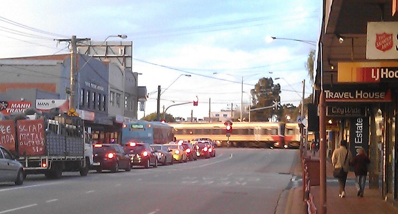
For example, the Footscray Road level crossing to the Port of Melbourne was classified as ‘Non-Metro’ – yet the amount of delays caused by 1.5 kilometer long freight trains passing through it at 25 km/h were massive. Compare that to the delays caused by a suburban train every ~40 minutes at the far end of the Hurstbridge line.
#145 Taylor’s Road has been separated but I’m not sure which year
It does seem very spurious to claim credit for grade separations where no level crossing previously existed. How far would this extend? Will someone go as far as to take credit for the Peninsula Link bridge over the Mornington line?
My notes on ALCAM show 1,887 level crossings, including five they missed. What criteria did you use to cut that down to 345?
Worth noting that about 75 level crossings have had rumble strips and advance warning signs added in country areas; also the upgrade and removal of hand gates from New St (no. 223 on the list), and boom barriers have been added to a few level crossings on the Puffing Billy line. Also, the Risk Score is a 2008 number; they’re all out-of-date now with increased rail and road traffic.
If the “grade separation” concept is defined as loosely as “construction works built to separate (potential) rail from a road” then 40 works:
Road bridges over rail lines:
3x Mitcham project – Rooks Rd, Simlar St & Mitcham Rd
2x Springvale project – Springvale Rd, Warwick Ave
13x on RRL (Bulban Rd, Black Forest Rd, Greens Rd, Manor Lakes Bvd, Ballan Rd, Leakes Rd, Davis Rd, Tarniet Rd, Derrimut Rd, Dohertys Rd, Boundary Rd, Western Fwy, Anderson Rd Ballarat route) plus
1x Christies Rd (Ballarat Line) plus
3x on South Morang line (opened 2012) plus
Road bridge under rail lines:
1x Anderson Rd (Bendigo route)
Roads cut off instead of bridged over RRL
2x Gard Rd & Sayers Rd
Promised, partly or fully funded:
4x promised, funded individually – Burke Rd, North Rd, Main Rd and Blackburn Rd plus
4x promised, funded as part of CPRCP (Dandenong line project) plus
7x promised as part of CPRCP (Dandenong line project)
There’s also the option of counting McDonalds Rd at the down end of South Morang, if the cutting extends under the road (it’s hard to tell from photos). And the two rail-over-rail flyovers included in RRL, and perhaps other RRL bridges i.e. Ashley St Tottenham. Depends how far you want to stretch the figures.
In any case, of those the only cases that conform to the “normal” definition of Grade Separation – removing an existing road/rail level crossing and replacing with a bridge for one or the other – that were announced, funded, started and completed by Liberals would appear to be Rooks Rd, Mitcham Rd and Springvale Rd. I’m not sure if the two Anderson Rd crossings were included in RRL plans before the 2010 election?
Further thought: based on the current Government’s apparent definition of “Grade Separation”, how many would they count if they agreed to deck over the rail lines between Federation Square and Batman Avenue?
What frightens me is how the top priorities have seen wilful cherry-picking.
Yes, state governments, why not do priority #270 for $170 million and leave priority #9 unpledged!? That will be politically brilliant! No wonder us regular humans are so cynical.
(also: Daniel, any insight into the meanings / derivations of those risk scores that determine the priorities?)
Curses! David is right. What I’ve done here is only include the first two pages of the ALCAM report, eg the first 345. Must have happened when I was pulling the data out of the PDF. I’ve just chopped it down to an even 300.
I’m not going to add the other 1500-odd to the list, as I think listing the first three hundred-odd makes the point — the highest-ranked Metro crossing is number 299. The full list if anybody wants it is here: http://goo.gl/qFqlHS
@James, thanks! The ALCAM list still had that listed, even though it was grade separated in 2007. Have updated my list.
@Jase, remember the ALCAM score is about safety, but governments will obviously also prioritise politically popular locations (which might relate to road delays rather than safety), and also economic impact, which was the case for Footscray Road. As Marcus notes, the delays there for traffic (including one of Melbourne’s most frequent buses) were long — you could be stuck there for 10-15 minutes just waiting for one freight train to slowly move through. (See pic here.)
Oh man I wish I’d known about Tableizer back in my IT days. That would have saved me a huge chunk of time.
Number 32 on that list (Clyde rd, Berwick) really should of been done when they were duplicating Clyde road. Seems like such a waste of money to be doing work they could of done in one big hit.
Even its ranking is surprising. Given that southbound there are traffic lights that go red before a train comes.
Technically, the Altona Loop crossing on Kororoit Creek Road is on the boundary between Williamstown North and Altona. The station named “North Williamstown” is in the suburb of Williamstown, and the suburb of Williamstown North actually encompasses the industrial area that you can see as you travel along the Werribee line between Newport and Altona Junction… So Williamstown North is actually west of Williamstown…
Anyway, that was my dose of pedantry for the day. Nice work here, Daniel!
I guess the re-opening of the rail/road crossing in New Street Brighton last year counts as a minus one?
How do they valueate the risk at these crossings?
I am surprised to see Webb Street being more dangerous than those in Noble park which would have double the train service to that of Narre Warren?
Utopia, anyone?
Minor point of order.
Ferguson Street is the crossing at North Williamstown station. Kororoit Creek road doesn’t commence until the roundabout.
Kororoit Creek Road is the crossing just south of Altona Junction, located in Williamstown North.
Two separate crossings, located at either end of the suburb of Williamstown North.
@Jase number 9 on the list has the problem of City Link above and Mooney Ponds Creek below which basically make grade separation next to impossible. the next down is Union Rd which is a local road with a grade seperated crossing within about 350m. Aviation Road at number 16 might be justified but once again is a local road and you would question doing it ahead of an arterial.
@Brad. Clyde Road will be done via rail lowering due to the hill for the rail. Meaning the station etc. needs a rebuild. The significant skew on the crossing and nearby access means road over or under isn’t an option. The duplication still divides the road and improves safety and capacity until the rail can be justified. Im surprised to see it so high up the list compared to other crossings on the Dandenong line.
Another high up the list one that should be done is Old Geelong Road, Hoppers Crossing, #19. Multiple reasons:
* Insanely busy on both road and rail.
* Werribee Hospital is across the road. Ambulances frequently get stuck at the crossing (just like at Clayton)
* Safety risk. Level crossing/road is curved, so southbound traffic can’t see the other side of the crossing until you are on it, causing frequent queuing over crossing.
* Proximity to major highway, 100m to the south, which also causes queuing.
Also, for AustinM: The #9 crossing isn’t that Macaulay Road crossing. It is the one at Kensington station about 400m west. The one at City Link (at Macaulay Station) is #77 on the list.
@Flanders – Thanks for the correction. It seems having 2 on Macaulay Road in close proximity with 1 being in the very hard/near impossible would justify leaving them off the priority list given its a local road.
The ranking of some of the crossings shows the skew or visibility of approaching trains really pushes up the ranking in spite of a crossing having boom gates. Whilst it seems fair that the scores would be lifted slightly to account for this factor it seems to have a very high weighting given the all the crossings up the high end of the list are boom gate controlled crossings.
Its also amazing that Clyde Road with less trains and I imagine less cars could be within 2 of Heatherton Road.
CLYDE ROAD COUNT
Clyde Road should have less than half of the trains that Heatherton road gets.
Most of the day, there would be half of the Metro trains with the other half going to Cranbourne.
In peak, there are also Dandenong shorts to count too. On the other hand you have all V/Line services at both crossings.
While on Clyde road, my guess is that a lot of local traffic may use the current rail over bridge just near the school. It was expected that Clyde road would need to have a capacity increase, not because of local estates, but to link the Monash Freeway with South Gippsland highway at Five Ways. In effect function as a bypass around Cranbourne.
WEBB STREET, Narre Warren.
Being a local, who uses that crossing a fair bit, I can provide some local feedback about.
It is ironic that only 300m to the east, there is a bypass road. Cranbourne road was fully grade separated I think 10 years ago?? along with widening of the road from one lane to three lanes each way.
Most of the traffic in Webb street are through traffic, coming down off the Shrives road direction. There has been a lot of talk about diverting Shrives road so as to divert this traffic away from Webb and onto Cranbourne road. I can imagine with that diversion done, Webb Street shall drop in priority.
The road diversion currently has a set of traffic lights which had a very long cycle. To the point that people ended up finding that Webb street is somewhat quicker.
HALLAM ROAD
You may get a lot of traffic operating between Hamption park and the Monash Freeway. Although us at Narre Warren would always prefer to go Pound road, South Gippsland freeway should we ever drive in that direction. Even South Gippsland highway is best for trips to/from Dandenong.
Hallam road should be easy to do with a simple flyover done.
With Reservoir station. If we bury it, we can connect Broadway with Edwardes St. That would be a treat.
Also if we elevate Reservoir, we can also link those two roads directly.
I say that Reservoir is more likely to go up and over given the underground water supplies in that location.
I believe that most of Melbourne gets their water via pipes that come in through that area, and it would cost way too much to play with them.
Then again, Springvale cost 3x the amount of going over and yet we went for the 3x costly option.
I agree with @Tranzit Jim. And at 1/3 the cost per crossing, by using elevated rail wherever possible, the state will be able to have three times as many for the same budget, and perhaps also in much less time with far less disruption. There are many other benefits of elevated rail over trenched rail. While most of the time, level crossings and grade separations are seen as a transport issue, primarily for private cars and trucks etc by the wider community, and as an impediment to better PT by those in the know, there are significant issues to do with urban amenity of the precincts around them that should be considered as part of every grade separation project.
Lets start with the ‘as existing’ conditions. An at-grade railway is a barrier to crossing at all points along its length apart from those places that are legally sanctioned and surveilled. Of course, people can, if they wish, still cross the line at many places, so the severance between communities on either side of the line isn’t total. But any cursory analysis of the connectivity across rail lines will show that for pedestrians and cyclists the severance can be severe, forcing people to travel much greater distances than otherwise to get from one side of the line to the other. With trenched rail lines, along the length of the trench, this situation is usually made worse. The trench makes the track alignment totally impassable due to the changes in level, and the anti-suicide fences along the tops of the retaining walls make the danger clear. The length of the severance is significant – often up to a kilometre either side of the ‘buried’ station, with the new bridge over the station being one of the few places to cross the tracks. Bridging and decking over trenches is expensive, so there are few additional crossing places provided beyond the station itself.
With an elevated rail line, the space beneath the viaduct allows as many crossing places to be provided as required to meet the local communities’ needs for pedestrian and cyclist connections, and even, additional vehicle connections. The land beneath the viaduct is effectively ‘free real estate’, since the state already owns the land, and it can be put to a wide variety of uses to meet the needs and aspirations of the local community. While it is true that at the ends of the viaduct where the inclined sections return to grade, there will be a length that will have insufficient headroom to provide new connectivity at ground level, but the overall potential to provide ground level connections and improved amenity for local communities will be far greater with elevated rail than *any other* grade separation approach (other than fully-tunnelled alignments, but these are too expensive to ever be used in anything other than CBD and other very high-value land locations).
Some may be skeptical about elevated rail, partly because experience of it in Melbourne is limited. People ask: What about the noise? What about the space under the viaducts? What about the visual intrusion of the stations and the viaducts? In answer to these concerns, let me first say, these questions can best be answered by the evidence available from the many instances of elevated rail across the world – from North America, Europe and Asia, all places that have built elevated urban rail systems in the contemporary era with outstanding success.
Firstly, the noise. Sound abatement technology is well-developed, there are many ways of achieving the necessary sound reductions, in short, it is not a problem. It is however an opportunity for designers to make the viaducts more attractive through innovative approaches to the form, texture and shape of railway sound barriers – much in the same way that Victoria builds the world’s most artistic sound walls, we could do the same for our urban rail alignments, though they would not need to be so sizeable!
Second – the space beneath the viaducts. Many have indicated concern that this space could be unattractive, dark, dingy and attract anti-social behaviour, most likely due to experience with the spaces beneath freeway and other arterial road viaducts in Melbourne and elsewhere. However, unlike road viaducts, rail alignments require much less space to move the same quantity of people per hour. This means rail viaducts in general will be much narrower than road viaducts. Also, the quality of the space beneath the viaduct is determined by the height and shape of the structure. There are many ways of ensuring that viaducts can be attractive to the eye and sufficiently high above the ground to achieve a sense of space and light beneath. For example, in Vancouver which has an extensive elevated rail system, many of the spaces beneath the viaducts pass through are attractively landscaped reserves and parks.
Third – the visual impact of the stations and viaducts. One of the problems for many suburban stations across Melbourne is that they lack civic presence, as well as providing low passenger amenity, difficult way finding and poor intermodal connectivity. Elevated stations are an opportunity for taking station design, and importantly, the precincts around them, much more seriously. Given the significant savings of elevating rail lines (1/3 the cost of trenching for grade separations), then it could reasonably expected (and convincingly argued) that some of the savings overall should be re-allocated to better station design. To this end, this would mean complete protection from wind and rain with shade from the sun. It should also mean complementary facilities at stations – like cafes (not just kiosks), newsagents, groceries and supermarkets, key cutters, heel bars, libraries and even, childcare and other facilities used by local communities and commuters alike. Such accommodation could easily be built on the land that becomes available beneath the viaduct – at much less cost, and far more financially plausible than on top of expensive decking over the top of a trench. Such stations would transform the perceptions of PT as well as the actual, everyday, lived experience of public transport in Melbourne – it would be a pleasure rather than a chore. And of course, if really necessary, some of the land left over beneath the viaduct could be used for station parking … though that’s another story.
And there is one last point about elevated rail, well, actually two.
Firstly, thinking about grade separations as opportunities to improve the overall level of amenity and connectivity means that they need to be seen beyond a collection of one-off technical exercises. Once the implications of grade separations as elevated (or for that matter, trenched – the inclines and the lengths of track affected are pretty much the same) are looked at in detail, it becomes clear that cherry-picking them is likely to result in some negative urban outcomes on the ground, beyond those already identified for trenching above. In many instances, stations and roads crossing the line, whatever their designation, are too close together to allow the ‘one off’ grade separations to occur without impacts up and down the line. To achieve the required inclines, some smaller roads may have to be closed, or if not, then the elevated or trenched rail section must be longer, and this may then, in many instances, pick up more stations along the way. The alternative is to do a road-over or road-under rail separation. But in any urbanised situation where the rail line and station are close to or part of a local centre, however small, it will be extremely difficult, if not impossible to achieve a decent urban outcome this way. It is notable that VicRoads earlier this year rejected the ‘Grade Separation Lite’ proposal for road-under rail along the Dandenong corridor. The conclusion to be drawn from this is that grade separations, if they are to provide the best long-term urban outcomes possible, need to be considered as part of a strategy of looking at entire rail corridors as integrated urban ensembles. And if elevated rail is 1/3 the cost of the business-as-usual trench, then there could be three times as many, and thus, elevating entire sections of line becomes a possibility, with a range of attendant benefits that multiply. After all, if we are to think about grade separations purely from a public transport perspective, then the we need to think about what the impact of level crossings is on rail service frequencies as well as buses, a few trams and private vehicles. Which level crossings need to be removed to ensure that PTV can run as many trains as the 2012 Network Development Plan says it would like to do? And which level crossings need to be removed to run as many buses as possible to achieve the aims of the PTUA, the Greens and BZE for enhanced PT mode share? The ALCAM list is all very well, but its assessment criteria have little do with improving public transport services.
Finally, then, what about the experiential differences afforded by elevated rail over putting trains in trenches? One of the wonderful things about riding a train in Melbourne is that the majority of it is at or above grade. The passenger experience includes awareness of the seasons, the weather, the time of day, the locations being travelled through. This is far superior to the kind of passenger experience available on an underground railway, no matter how glamorous the city one might be in. The trouble is, it sometimes seems, with the penchant for trenching in Melbourne that the desire is to bury our rail lines as much as possible, to put them out of sight of the general public, while appealing to a misplaced notion of cultural superiority drawn from ideas about the underground lines in London, Paris, or New York. But unlike those proud traditions of urban transit platemaking, with their highly distinctive station designs, the enormous investments by the Victorian community in trenches have primarily given passengers hundreds of metres of grey shotcrete!
We can do so much better!
Thank you, Ian Woodcock, for making a strong case in an area we have been largely blind-sided. I was in my usual local minority of one in preferring VicRoads’ rail over option for Main Road, St. Albans, but have not until this morning tried to apply that thinking more widely. Now it is coming together spectacularly as the best opportunity to reinvent Melbourne’s transport mix as desperately required during our next ~40 year population doubling, coupled with realisation of just how much of a starting point is already in place.
Jan Gehl, Rob Adams and the Lord Mayor make a passionate case for prioritising human scale design over the helicopter view, but we will need to directly tackle the one potential downside that the current aesthetics of elevated rail aren’t automatically more attractive from that metaphorical helicopter than the tangle of free?ways we are rapidly learning to hate. Habituated to the idea that the likes of Jolimont, Dynon and Everleigh can only be seen as development sites, nobody without spray can in hand has asked how the 150+ year old design of rail tracks might be reconceived with post-Gulag aesthetics but we are already starting to do better than Williams Landing.
“Legibility” is rightly being recognised as a primary objective of public transport design, and a clear advantage for trams that the bus totalitarians don’t want mentioned. Elevated heavy rail doubles the legibility dividend. You can both see it from further and see further from it, the latter at least potentially requiring a more imaginative solution than the sound barriers which have been only recently forced on new rail, RRL in particular. Surely the conceptualisation of elevated train stations and rail tracks atop human-scale amenities should be the perfect project for architecture and design classes in 2015.
Nothing comes from nowhere, but rail thinking like rail itself can emerge from tunnel vision. I’ve been looking without seeing this potential in recent weeks by making a couple of Hyperlapse videos holding my iPhone against train windows, the first of the standard gauge line from Southern Cross to Broadmeadows via Sunshine and the second of progress with the stabling works at Calder Park:
The story about St. Albans gets more interesting the more I hear about it. Perhaps the elevated option didn’t get up in the end (pardon the pun) due to inadequate representations to explain its merits; perhaps, if the brief had been to think about the Sunshine-Sydenham corridor as a whole rather than a single level crossing, the merits of elevated rail would have been clearer to all concerned. I’m keen to know more about what happened there, for research purposes, since I’m writing about the process of dragging Melbourne’s 19th century rail system into the 21st century.
The thing about people’s perceptions of elevated rail that I omitted to mention above (although it was in my mind) is that it’s not actually true that people lack experience of it in the Melbourne context. There is quite a lot of elevated rail in Melbourne, but people tend to forget it’s there it’s so much a part of their ‘taken for granted’ sense of place. Of course, most of it isn’t on viaducts, it’s on embankments, but it’s elevated all the same, with many rail bridges in many, many places. And what’s more, large parts of it run through some of Melbourne’s most desirable suburbs – Canterbury, Chatham, Hawthorn for example. Glenferrie, Auburn and Canterbury are all elevated stations in heritage protected, leafy suburbs. Swinburne University has an elevated rail line running through the middle of it – does anyone complain? No-one is calling for these stations to be sunk into trenches or buried away out of sight. And we know all too well how the people of Camberwell demonstrated passionately when it was proposed to build over the top of their local station. The rail-travelling public of Melbourne know very well the pleasures of elevated stations and the richness of the connections, visual and social, that they can afford with their locales.
I like those clips, Tony Smith! If you have the time, it would be great to try a similar exercise going east from Richmond (to showcase the elevated sections out that way) and north east from Jolimont to pick up the elevated sections in heritage-rich Collingwood …
As for architecture design studios, I am hoping to run some of those again, and yes, we did run a series of three of them from 2013-14, culminating in an exhibition of the work and a (limited print run) of a catalogue summarising the results. Thankfully, luckily, Adam Carey of The Age took a keen interest in the project and gave it a double-page spread when the show was on. Here’s the link:
http://www.theage.com.au/victoria/drab-train-stations-come-to-life-in-university-design-project-20140616-zs9r7.html
The fact is that road over or under existing rail should always be preferred as it costs far less. You just have to think about roads being able to go at 5% grades as opposed to the 1-2% of rail which significantly lowers the expensive high fills/ high cuts and earthworks scope. Whilst they often have property acquisition and access restoration costs this would usually be far less than the new station rebuild costs alone (most new stations seem to be running at $50m+ stand alone).
If there is much higher cost options like lowering rail or raising rail then local councils should be stumping the additional costs if they feel so strongly that the additional local amenity improvements are worth the $50m-100m of addition to the costs of these grade separations (through a one off rise in local rates). These amenity improvements are a benefit to the local community and not the state and should thus be paid for accordingly the grade separation in itself is usually a massive local access and amenity improvement paid for by the state.
Daniel, interesting list, and Labor’s is an interesting list too! Some of those Frankston line annoucements make absolutely no sense! Station St, Bonbeach, Station St/Edithvale Rd, Edithvale? How is that going to work? And of course, while it would be impossible, no mentions of the two crossings in Mordialloc or on Station St (Mordi? Aspendale?) next to the creek/Mordialloc College, or in Carrum (up side, but close to the sidings); those ones are the busiest for trains or for cars, and also seem to be some of the most dangerous from noting the number of crashes/deaths along the line (Carrum is particularly bad).
n
I have spent a lot of long journeys to Frankston wondering how the line could be grade separated. Mordialloc is impossible without losing the stabling sidings (although sell the land and build them elsewhere and it could be an asset). Same with Carrum. And the stretch between Mordi and Carrum is just weird, two roads (Nepean Hwy and Station St) paralell with many crossings, all on a sand dune near the beach. Going down/under would be a geotechnical nightmare from the seepage in the area. Sand near a beach does not sound like fun to permanently dig into (even though apartment basements do); would assume it needs very good pumping. Going over would cut the (visual aspect) of the existing communities in half (but there are sections where the line is much higher than the surrounding houses, but that is old and mostly natural).
So I have no idea how they’ll do it. Or if it is even needed along that section of the line at all (some road congestion at points, but it is MUCH worse elsewhere!)
But, on the point of how to approach these projects, Ian raises something I only came to think about seriously after seeing his work in the paper (interesting it was!). I had always seen rail embankments as being nice for rail users and elevating the visual status a lot, but being a detriment to the communities around them (noise, overlooking, etc). A historical thing that we had, and people accepted. I still think most people would see it like that, and complain to the bitter end about being overlooked by a new railway.
But there are significant advantages from railways being at or above the surface through Melbourne. One being that mobile phone reception isn’t quite as bad (and travel travellers sure love their mobile devices these days). Another is that the amenity of the journey is much greater, with natural light, a view, looking over the suburbs and seeing the greater extent of the people and places we live in, and not being within a metre of drab concrete/shotcrete wall (which makes everything seem much less safe/crime-ridden and less pleasant).
The elevation of the railway above street level also means that people acknowledge that it is there. It is very hard to miss the railway on Glenferrie Rd or Auburn Rd, Hawthorn, for instance. It is an integral part of the landscape and the experience of the area. It is intruding, but you also know instantly that there’s a station nearby.
The station designs shown in the concept work for that architectural studio study are very interesting. The idea of completely transforming the urban environment by elevating stations and making them an architectural centrepiece is very NOT Melbourne so far, but it would make the role of rail and the station itself in the community more obvious, more anchored. I found many of the designs weren’t workable, they are not good designs from a practical standpoint (but much of architecture doesn’t seem to work like that), and I don’t think they studied the wider transportation context and integration into a continuous urban framework of the road network, surrounding PT network, train line in totality. But I never thought that was the point. The point was to explore ideas, and potentially inspire people like me to think differently.
Comments about the good/bad aspects of rail above road in urban areas, particularly through residential and commerical-shopping neighbourhoods are interesting. Somewhere like Springvale I don’t think it would have mattered much, and as it stands the new station design does seem to be compromised (and cost a LOT of money). The land around the area is either industrial or lower-quality, lower-income, lower-density suburban housing, or the giant station carpark. The noise aspects of the very short section of sunken line wouldn’t make a huge difference overall if elevated, and there was heaps of space. If it were elevated, most of it wouldn’t have been on a viaduct, but probably on an embankment (also, less maintenance required).
Something I have found interesting is that no one is worried about vehicles falling off road bridges in the trenched rail line any more (this seemed to be a concern a few years back?). Rail over road mostly fixes that (but adds the potentially much less deadly bridge-strike to the equation).
There are locations where rail over road is probably not a good option. Ormond is probably like that due to the local geography. But along the Dandeong corridor it doesn’t seem like it greatly matters either way. If the space above the line isn’t appropriately developed (allowing for quadruplication!) then it is wasted if the line is lowered, given the additional costs.
Whatever the outcomes, developments like the road overpasses at West Footscray, Oakleigh or Huntingdale are not ideal (and really split communities, and even roads), and I hope we don’t end up building more examples like that. I genuinely think that Oakleigh could and should be redeveloped to remove that overpass, probably sink the line (depends) and completely change the entire precinct, but I know it will never happen due the cost of fiddling with something that already works. We do seem to be very good at now burying our pesky railway lines below roads to allow cars to drive more freely and to put them out of sight (and out of mind?). Let’s hope it isn’t to our detriment.
Cal,
The simplest solution for the Mordialloc to Carrum section would be to elevate the rail line on either a long bridge or long embankment.; or most likely a mixture. Mordialloc, Carrum and Frankston sidings are all expected to be abolished and replaced with a new facility near Baxter sometime in the not-too-distant future.
At Mordialloc, there is more than enough room for a smooth ramp from the Nepean Highway rail overbridge towards McDonald St, which would elevate the railway by about eight metres. You’d then have four (not three!) tracks splitting to make room for two island platforms, which would stretch from roughly the current underpass to directly west of the Albert St / Park St intersection. The line would then remain elevated until past the current Station St level crossing just south of Mordialloc Creek. That’s three level crossings gone.
At Carrum, I’ve been considering closing both the Station St level crossings either side of the Patterson River; then add a new bridge for Station St over the river, and a single road bridge linking the Nepean Highway and Station St similar to the link at Sutherland station in NSW, with the rail-side lanes of each road elevated and the shop-side lanes of each road unchanged.
In any case, Carrum station will need to be moved south when it comes time to add the third and fourth track.
Aspendale, Edithvale and Bonbeach are similar to Carrum – the practical choice is either to elevate the line or to build single-direction linking bridges per Sutherland. Chelsea is probably best off elevated with room for four tracks in any case, shifting to the southern end and former goods yard plot.
If more room were required for the rail line, an option would be to make Nepean Highway northbound only and Station St southbound only, with lanes removed from the former and added to the latter to compensate. I don’t know if there are any local precedents for that sort of work (besides possibly Wycheproof), though I expect it could be made to work.
The biggest concern I have with elevating rail and selling the land underneath for shops, is whether the local market could support that level of investment. I recently investigated abolishing the Abbott St level crossing at Sandringham and elevating the rail platforms and sidings there; the cost of construction could be anywhere up to $200mil, but revenue from shop sales (with shops only on ground level) might only be $70mil per level. Or if the shops were rented out at current local market rates, the revenue would only be around $7mil per level per year. In both cases adding levels above the elevated rail sidings could work from an engineering perspective, but it raises the question of whether or not Sandringham could support that amount of retail. From memory I worked out that if the structure was to be a mixture of residential and retail, with the railway taking level 1, to pay for itself within a year of opening would require a 15-storey structure with all properties sold.
Ian may correct me, but I think one of the biggest limitations in how far his project could stretch was that the local councils funding the project explicitly stated which stations were to be investigated, so there might not have been much scope to play with local transport options in general. That said, a lot of the designs’ merits can be hard to find if you don’t immediately appreciate the architectural style. Personally, I particularly like Hartojo’s Moreland design (and Yusof’s Burnley and Yang’s Moreland have grown on me), but some of the others don’t sit well with me – for example, Wachtel’s Pascoe Vale, which reminds me of the bridge piers for the new line between Clifton Hill and Westgarth. The Pascoe Vale design isn’t nearly as bad as the bridge piers, but the style of both look like someone sneezed acid on them.
You commented that Ormond’s local geography is a restriction that would preclude rail-over as a grade separation option. I disagree. Taking into account the current line elevation profile from Caulfield to Moorabbin, I found that elevating the entire distance would give the smoothest rail-height profile. In terms of integrating that with the local road heights, I’m quite partial to the creative building level numbering employed at RMIT north of Latrobe St, and Victoria University (Footscray Park) against Ballarat Road. In both cases the main entrances are on level three, with the structure extending both up and down and level one being matched with the lowest ground level entrance. To apply that principle at Ormond, the rail and platforms could be on level 2, with two levels of shops/residential below that; level 1 matching with current North Road shops northeast of the crossing, and the ground level shops matching elevation with the shops on the northwest side.
West Footscray, Oakleigh and Huntingdale are not the only post-WWII grade separations where the cheapest option was employed at the expense of community permeability; others are Burnley, Newport and Sunshine, and Frankston would be on the list as well except that the pedestrian crossing was, thankfully, retained. Albion, Westall, Somerton Rd (near Roxburgh Park) and Koroit Creek Rd (between former Paisley & Galvin) are arguably in the same category, though all of those are around (formerly) industrial sites. It will be interesting to see whether they become a problem in the future.
I agree that Oakleigh will need to be addressed sometime in the future, though I’m not sure how given that the station is heritage protected (it, Box Hill and Essendon were built to similar plans; Box Hill was demolished in the early 80’s and Essendon is built reverse). In any case, getting four tracks through the existing site would be fairly straightforward – either turn the current side platform into an island, or run the down express line along the former 2A alignment, and the up express line along the former 5A / loco runaround alignment on the south side of Platform 1.
The best opportunity to address Huntingdale would be in conjunction with any Rowville line works; it also raises the question of whether or not only one of Huntingdale and Oakleigh should be made a major interchange point, since having four consecutive major interchanges at Monash, Huntingdale, Oakleigh and Chadstone could be seen as redundant.
I’m not sure what sort of solution would work best for West Footscray, though I expect that medium to long term (as the bridge reaches its use-by date), there could be an argument for elevating/dropping the entire Geelong Rd alignment, bar slip lanes, from Ballarat Rd to the Westgate Freeway. This would allow all the side-roads either side to properly connect, and vastly simplify intersections like Somerville Rd / Roberts St.
Sunshine had the chance to be fixed with RRL, but we missed that opportunity and instead elected to add a fourth platform and replace the concourse. Understandable given funding shortages, but unfortunate all the same. I’d be tempted to check whether Monash St could be linked to Durham Rd across the rail alignment, though with only 70 metres from existing intersections to rail alignment on each side it would be a tight fit.
Burnley and Newport were both addressed in the Transit for All project. I have already commented on Burnley; as for Newport none of the three designs feel ‘right’ to me, but that’s largely because the road network in the area is such a hideous mess to begin with. It’s quite clear that the main roads either side of the railway weren’t planned as-such, but rather grew like an amorphous fungus. The bifurication of the south side Melbourne Road makes little sense considering the congestion on the north side, and the reduced traffic on North Road post-Westgate (the 1966 Melway references a ferry across to Williamstown Road, possibly a predecessor of today’s upstream Westgate Punt). Most likely is that at some stage there were plans to fully duplicate Melbourne Road by purchasing the houses along the eastern side, between there and the railway. That may well still happen, though of course it has been far less urgent since Williamstown ports were overtaken by larger, more recent builds. I expect there are also, or at least were, plans to extend High St to link to Melbourne Road. In any case, my view is that a short-term issue which could be solved is that the underpass linking the platforms, which then raises to ground level and passes under the Melbourne Rd bridge, is claustrophobic and difficult to navigate if you aren’t intimately aware of the area’s layout. A solution to this would be to fill it in with concrete and build an elevated concourse like the one at Sunshine, with accesses both sides of Hall St and also at the northern end of Market St. This would better link the bus interchange with the rail platforms and lessen the divide between the two town portions. Additionally, this would allow the current dual gauge line to be split into one standard and one broad, allowing what would effectively be a platform zero. It would also eliminate the staircase access to the Parkiteer bike cage.
Interesting David, and a thoughtful and wide analysis on a large number of sites.
That design for Mordialloc was all I could think of, too. Grades at the up and down ends would work well. And yes, pointless to retain yard (still not sold on the Baxter stabling yard, given how far it is from the current network, but I guess it would have a huge amount of space).
I can understand possibly having a larger number of platforms at Mordialloc, given it is a natural terminating point for short run services. But why would you ever need more than two tracks beyond Mordialloc to Frankston? Even if suburban services were extended down the Peninsula (why? It isn’t likely to grow very much, it isn’t a growth corridor), it would be illogical to run normal express trains beyond Mordialloc. We are constrained by three tracks further up the line anyway, and that is unlikely to be expanded upon for decades, if ever (so many more worthy projects first, too).
As far as I know any frieght route from a potential Port of Hastings are to go via Dandenong, because it would be more useful: inter-modal terminals in that region, and need to expand Dandenong corridor anyway. That would be the only use case for more tracks on Frankston corridor, and unlikely.
Comments about the wonderful road over rail projects are interesting. Many suck. Forgot about Newport et al. I assume Broadmeadows, Strathmore (?) on Pascoe Vale Rd fall into that category?
But an example like Westall is actually a good construction. Was very very needed, rail raised or lowered would have sucked. Road could be lowered, but I assume easier to go over. There are some residential areas but they aren’t impacted by the overpass. Generally not a terrible urban design.
Same at Frankston. I assume Fletcher Rd overpass is actually 1980s by the design. And it doesn’t have a terrible impact on the environment around it. Works well for traffic, and for trains. Site would be just awful without it, because trains would he waiting for road signals to meet some sort of sync before the could leave. So I don’t think that is an example of a poorly designed project either. Rest are universally terrible though! Heh.
Why would elevating rail over Westall Rd have been a bad outcome?
Ian,
Back in the 90’s, Westall was surrounded by rail sidings to a plethora of industries. Those yards would need to be flat for safety during shunting and stabling, and ground-level access would have made wagon loading/unloading much easier. This diagram is from 1975:
http://signaldiagramsandphotos.com/mywebpages/vr/Metropolitan/6%2775.gif
Cal,
Re stabling on the Frankston line, the original scheme was for a yard at Langwarrin in 1981 – http://img687.imageshack.us/img687/3327/langwarrinstation.jpg
That can’t be built today because standards have changed – we need to allow for longer (straight) platforms and trains, for example, and the 1-in-8 ramp onto the platform is not compliant with the current disability/access legislation. I’m not sure when the plan changed to but the yard at Baxter, though I suspect it has something to do with the early 90’s advocacy for restoration of the Mornington Line, hence arguments for electrification to Baxter rather than to Somerville.
(Of course Mornington restoration will never and should never happen, given the lack of population at Moorooduc and that any train would only save a few minutes over a bus along Nepean Highway.)
I’m allowing provision for four tracks to Frankston as a rule of thumb – two tracks should be limited to one average speed (i.e. stopping trains) and any third track is and will be useless, ever since we abolished Jolimont stabling yards as a location to hold the extra trains between peaks. Also worth considering is that Frankston could still grow considerably; it’s been marked as a place of interest as far back as MOTC and that’s still true in PlanMelbourne. I’m also not sure of the current status of plans for the rail line down the side of the Westernport Highway.
Re Broadmeadows, I’ve only been able to determine that the grade separation occurred sometime between 1969 and 1979. I gather the crossing was upgraded from gatekeeper to flashing lights in 1961 as part of the Standard Gauge project.
It seems Pascoe Vale Road, north of Strathmore station, was grade separated sometime between 1963 (diagram 6’63) and 1966 (Melway Ed1, 1966).
Ian, my thought would be that it is primarily an industrial area (with a lot of land available, and a road network suited to it; there is housing and a small shopping strip nearby, but it is on a side road), on a major industrial/link road, and there is no advantage gained by raising the rail. Likely costs were lower for a new road bridge (and not needing to close the railway for an extended time or touch it at all) given road traffic could have been diverted on a temporary road at low cost. Also, no change in rail grade (which is ‘flat’ through the area). BUT mainly, because the rail workshops and associated track points to enter them are right next to the Westall Rd bridge. Moving the workshop would cost a lot of money, money not well spent. Also, station is just on the up side of the road bridge, and moving and/or reconstructing that would also have cost a lot of money. (It was rebuilt years later at great cost, but that was an entirely separate and in the end nearly-pointless/shortsighted project).
Basically, road-over-rail has few societal/urban design drawbacks in this case, and would have cost a huge amount less. (It is a busy six-lane highway, before the early-2000s upgrade that constructed the overpass too, it was a busy but narrow two to four-lane road with a level crossing.)
Thanks David and Cal for your answers about Westall. I can understand why you make that case now. Mind you, whether an area is industrial or any other use, elevated rail lines allow much greater possibilities for change and development as time passes than tracks at grade. Thinking about elevated rail also means that additions and extensions to the system become much easier, since the alignment can pass through many areas that would be difficult/impossible at surface level. Of course, tunnelling also has this advantage, but it’s prohibitively expensive in all but the central city and other high-value commercial areas.
If one imagines Melbourne’s future long term – say, 50 to 100 years ahead, with 2, 3 and 4 times the population of today, then strategies that allow maximum expansion of rail services, with potential for urban renewal and transformation at stations need to be considered a priority rather than short-term solutions.
I cannot understand why 21, 71, & 75 are on on anyone list, the scores are low, but I would attribute this to the fact that they are still manually controlled, but they all have a major impact on the running of trains, as they are limited to 15-20kph through them (As there is a tram square, at the different voltage to turn off) Removing them would not only save train passengers time, but woudl save on a number of wages
Seems strange to include Nth Williamstown as it is a branch line with lower transits. Then I cannot see Spotswood on the list at all. Which is high traffic and closed more than open for peak periods. A new crossing one block north at the Avenue across to Simcock Ave would be a no brainer as the grades alter and it would take the trucks out of the shopping strip near the station that use Hudson rd now.
Level crossing separation is a good thing but I’m concerned that this is a good way to pad out the cost of a proposed new line so Governments shy away from the cost.
For example, what happens if the Government decided to reinstate the Leongatha service (as they tried to do a few years ago) would such a proposal be padded out by level crossing separation and deemed too expensive?
Even the Bracksy reinstatement of the Bairnsdale line?
Possibly level crossing separations are decided on traffic numbers but some people would like to remove level crossings altogether and this may delay or reduce rail proposals alltogether.
I thought the South Morang line eas padded out this way but improvements all the way to Thomastown were carried out.
I think new rail lines should be minimally built with crossings and stations with bus shelters (instead of large stations) until they prove themselves rather than overcosted and then scrubbed.
I thought the extension of the Gold Coast line to Varsity Lakes was too expensive and may inhibit the eventual extension to Tugun and Coolangatta
Daryl – the decisions around costs versus value in relation to PT projects are hard to fathom. The Southland Station debate – a toilet-less, shelter-less, minimalist version for $13M versus a $45M design with the full compliment of facilities and amenity – left us without anything while the Southland mall sits mere metres from the tracks. However, in terms of the strategic transport planning issues, such things are a distraction. The focus on removing level crossings in the metropolitan area is (or at least, should be) about improving the overall performance of the entire PT system (trains, buses and trams) as an integrated network. Level crossings make it difficult, if not impossible to increase rail frequencies – because more trains would mean boom gates being down for more time, causing more traffic congestion. More congestion means that improvements in bus services become difficult, if not impossible, because a very large number of bus routes cross rail lines, and so the timetables would become unworkable with buses stuck in tail-backs all the time.
There aren’t many places where trains and trams share crossings, but again, the same principle applies: increasing service frequencies would become very difficult for those lines that cross. However, at the same time, the fundamental principle of network planning in PT is the effective operation of the nodes where services inter-connect – trains, buses and trams ideally should be as close to each other at these nodes for ease of passenger transfer, yet at the same time, there should be clear grade separations at these nodes to allow as many services to be run as possible. This is the case whether services are planned according to pulse time-tabling or ‘turn up and go’ timetabling.
Pulse timetabling relies on all of the services that are intended to interconnect arriving at the node at their scheduled time – the model is based on minimising the ‘transfer penalty’ of the time taken to interchange between services, whatever their frequency – and on the reliability of the timetable. Delays create havoc with these key principles and the system breaks down. With ‘turn up and go’ the idea is to run so many services that timetables become un-necessary because waiting and transferring are minimised. This requires the ability to run as many services as possible – trains every 90-180 seconds is not uncommon; buses and trams every 5-10 minutes or less in some cases. Both of these approaches to network planning require planners to be able to guarantee their services. Without grade separations, and in many cases, the implementation of dedicated lanes for buses and reserves for trams (making them into light rail), it will be impossible to create the conditions for this kind of integrated, networked public transport system.
The regional lines that connect to the metropolitan system largely use the same corridors, and there would be flow-on benefits from a better metropolitan system for these services. Passengers arriving from regional areas would benefit from a better metropolitan PT network – after all, they arrived on PT at Southern Cross, they will want to get somewhere else after that: hire cars and taxis are expensive, being collected by hosts in cars is time-consuming – far better to continue to their destinations via high-quality PT. And once that experience becomes possible, then the demand for regional PT would rise and services could be improved and extended. That’s not to say they shouldn’t be improved and extended now, but there are constraints on such improvement until the metropolitan system is significantly upgraded.
Oakover Rd preston should definitely be on the list to be funded as the congestion during peak hour is terrible and the noise from the train horns every few minutes from 5am is unbearable! It even has a higher risk score than Rooks Rd, Nunawading which was completed!
Regional Rail link also knocked off Anderson Road on both the Freight lines and the Sunbury Line.
It all started in the “modern times” with Boronia Road grade separation in 1998 (a wet Cup Weekend) and then onto the others after a spell of a few years… Great information, I have a similar list with all the old grade separations in it… Warrigal Road at Oakleigh is Vic Roads main disaster and good example of what not to do… Cheers
It seems that their has been clarification as to which crossing in Bonbeach is being done – earlier references had been “Station St, Bonbeach” as per your list above, suggesting the one next to Patterson River – however now the LCRA refer to “Station St / Bondi Rd” in the list of eight accelerated crossings on the Frankston line – i.e. the one next to Bonbeach Station – http://levelcrossings.vic.gov.au/news/eight-more-frankston-line-level-crossings-to-be-removed
Indeed through traffic heading along Station St towards Frankston has long been encouraged to turn onto Nepean Hwy at Bondi Rd rather than continue to the end of Station St.
I wonder if someone has looked at a map, seen the proximity of the river and put Station St in the too hard basket for now?
I should add that Station St Bonbeach is 41 on the list and Bondi Rd is only 90…
But then there was accident in mid 2013 – http://www.theage.com.au/victoria/heavy-delays-on-frankston-train-line-after-crash-at-bonbeach-level-crossing-20130829-2suab.html
Having said that, trains pass through Station St at a greater speed as it’s between stations so it’d remain a higher risk.
[…] over eight years to reduce congestion and improve safety. This was a rapid acceleration of an existing program, which had sunk railways at ten suburban crossings since the 1990s. People knew changes were on the […]
[…] over eight years to reduce congestion and improve safety. This was a rapid acceleration of an existing program, which had sunk railways at ten suburban crossings since the 1990s. People knew changes were on the […]
Taylors Rd was in fact grade separated in 2008. The bridge was jacked into position in October 2007, but the road/rail interface remained until the underpass was excavated and traffic switched, completed in 2008.
Hi Daniel.
An idea has occurred to me regarding the proposed skyrail along the Frankston line corridor which I’d be interested in your feedback.
The thrust of my proposal incorporates several stages.
Firstly leave the crossings as they are (more later) and dig road underpasses , eg , halfway between stations.
Secondly, construct four long ramps parallel to the underpass from both directions either side of the existing railway tracks.
Thirdly, develop a sophisticated traffic light signal system to cope with the traffic. Lastly, put extra boom gates at existing and still-operational crossings.This will stop illegal passage but allow emergency vehicle and oversize/height trucks to be able to pass through under Metro Rail camera management.
Post script to previous comment.
Due to the high water table along Nepean Highway I would also envisage the existing railway crossing s be utilised in the event of flooding in the road underpasses due to an unexpected rain deluge.
@Peter, that strikes me as using a whole lot more space, using technically unproven methods, and in such a way that doesn’t properly solve the problem.
[…] over eight years to reduce congestion and improve safety. This was a rapid acceleration of an existing program, which had sunk railways at ten suburban crossings since the 1990s. People knew changes were on the […]
[…] Originally just removal of the Ormond level crossing was funded by the Coalition. The project was expanded to include adjacent stations Mckinnon and Bentleigh after Labor came to power in November 2014 with a pledge to start removal 20 crossings by 2018. […]
Your assumption that the Liberals counted 13 RRL grade separations as “level cossing removals” is proven correct in a DTF paper:
Victorian Budget 2014|15
Building a Better Victoria
Infrastructure Investment
Budget Information Paper
http://www.dtf.vic.gov.au/files/a989f424-a7a9-41e9-b8d2-a32300f7f18c/infrastructure2014-15word.docx
“Removing level crossings
The Coalition Government has allocated planning and/or construction funding for 40 level crossing removals and grade separations – the largest such program on record.
Since coming to office, the Government has provided around $1.8 billion to remove or commence planning for the removal of 27 level crossings. In addition, 13 grade separations are being delivered as part of the Regional Rail Link project.
The removal of five level crossings has been completed or is well under way, including Springvale Road, Springvale, Mitcham and Rooks Roads, Mitcham, and two level crossing removals at Anderson Road, Sunshine.
The 201415 Budget provides in excess of $1 billion to remove a further eight level crossings at the following locations:
– North Road, Ormond;
– Blackburn Road, Blackburn;
– Burke Road, Glen Iris;
– Main Road, St Albans; and
as part of the CranbournePakenham Rail Corridor project,
– Murrumbeena Road, Murrumbeena;
– Koornang Road, Carnegie;
– Clayton Road, Clayton; and
– Centre Road, Clayton.
Planning and preconstruction funding has also been provided to remove a further 14 level crossings, including $21 million in new funding provided in the 201415 Budget to commence planning for seven priority level crossing removals as the next stage of the Metro Level Crossing Blitz program.
The removal of level crossings at North Road, Blackburn Road, Burke Road and Main Road will support around 1 000 jobs during the peak of construction.”
[…] Originally removal of just the Ormond level crossing was funded by the Coalition. The project was expanded to include adjacent crossings at Mckinnon and Bentleigh after Labor came to power in November 2014 with a pledge to start removal of 20 crossings by 2018. […]
The fear of elevated rail is sad. London’s newer DLR line is a good example of elevated rail done right. It’s amazingly quiet (much quieter than living near Melbourne’s ground level lines), it blends in somewhat (though we could do better), but most importantly, it’s significantly nicer to ride than the underground (the majority of London’s network), having natural light and being able to watch the scenery go by. The underground is kind of awful, being in total darkness for 1 hour per day and being required to walk through kilometres of crowded pedestrian tunnels with poor airflow.
@Rob I think you’ve hit the nail on the head at the start of your comment – when it’s done right, elevated rail is efficient, quieter and can blend in pretty well within it’s environment. Sadly though, there’s a long list of public projects done poorly in Melbourne and I don’t think many people have the confidence our version of elevated rail will be any different. Based on the dreaded ‘artist impressions’ for CD9 the designs aren’t all that inspiring and given that’s all we have to go on so far the fear of elevated rail is understandable.
I lived in London for a couple of years and spent way too many hours underground on the Tube! But I’m not sure passenger experience should be prioritised over the experience of people living around the line itself. In terms of noise, light rail tends to be quieter wherever it is but with freight/diesel trains being serviced as well on the Dandy line I’m not convinced there will be a lot of difference (I remain hopeful though :-))