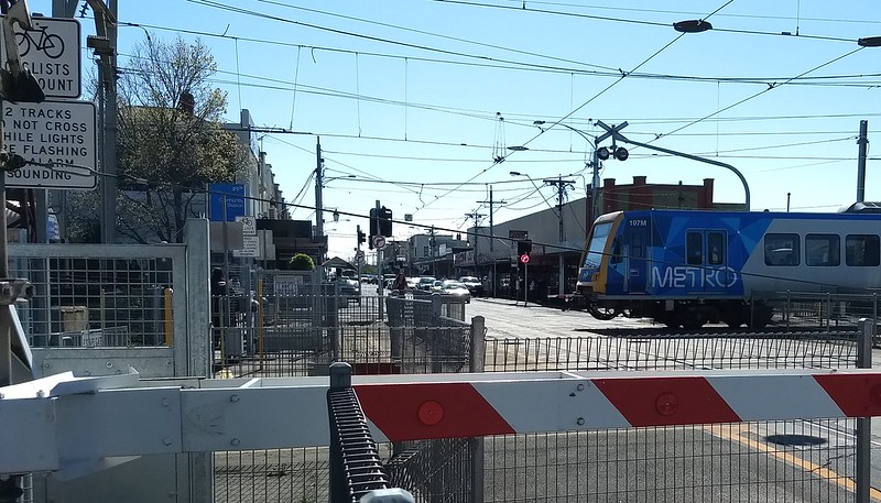
We’re midway through the state government’s 2018-2022 term, so I thought I’d do an update of the Level Crossing Removal Program status, following on from previous versions in 2014, 2017 and 2018.
EDIT: New update November 2022
Like previous lists, this one is derived from a 2008 ALCAM (Australian Level Crossing Assessment Model) study of all level crossings in Victoria – because it’s still the best source document in the public realm.
Back in 2008, there were 1872 crossings statewide, with about 10% of those being in metropolitan Melbourne.
I’m again listing the top 300 (which covers all the metropolitan ones) so we can see the progress – including those removed before the 2014 election when Labor’s ambitious removal program started up.
The list is still in order of risk as measured by the ALCAM study. Notably number 7 has probably dropped down the rankings since then because Geelong trains were diverted to the RRL line in 2015 – but the just-announced shift of some Geelong trains back to the Werribee corridor after track expansion is completed will change that back.
Even only looking at 300, it’s still a very long list. Skip to the bottom for some observations.
“Year” is the year of actual completion, or (for projects yet to be completed) expected completion.
| Rank | Location | Road | Suburb | Risk score | Current status | Year | Design |
|---|---|---|---|---|---|---|---|
| 1 | Metro | Springvale Rd | Nunawading | 14,648.42 | Completed | 2010 | Rail under |
| 2 | Metro | Springvale Rd | Springvale | 9,783.21 | Completed | 2014 | Rail under |
| 3 | Metro | Mitcham Rd | Mitcham | 8,139.60 | Completed | 2014 | Rail under |
| 4 | Metro | Main Rd | St Albans | 6,279.84 | Completed | 2016 | Rail under |
| 5 | Metro | Furlong Rd | St Albans | 5,019.60 | Completed | 2016 | Rail under |
| 6 | Metro | Bell St | Coburg | 4,646.03 | Underway | 2020 | Rail over |
| 7 | Non-Metro | Werribee St | Werribee | 4,540.20 | Underway | 2022 | Rail over |
| 8 | Metro | Clayton Rd | Clayton | 4,182.51 | Completed | 2018 | Rail over |
| 9 | Metro | Macaulay Rd | Kensington | 3,686.73 | |||
| 10 | Metro | Bell St | Preston | 3,686.30 | Planning | 2022 | Rail over |
| 11 | Metro | Glenroy Rd | Glenroy | 3,616.65 | Planning | 2022 | Rail under |
| 12 | Metro | Grange Rd | Carnegie | 3,578.22 | Completed | 2018 | Rail over |
| 13 | Metro | Cherry St | Werribee | 3,573.90 | Underway | 2022 | Road over |
| 14 | Metro | Union Rd | Surrey Hills | 3,448.01 | Planning | ||
| 15 | Metro | North Rd | Ormond | 3,348.95 | Completed | 2016 | Rail under |
| 16 | Metro | Aviation Rd | Laverton | 3,249.00 | Completed | 2019 | Road over |
| 17 | Metro | Blackburn Rd | Blackburn | 3,018.79 | Completed | 2017 | Rail under |
| 18 | Metro | Buckley St | Essendon | 2,948.38 | Completed | 2018 | Road under |
| 19 | Metro | Old Geelong Rd | Hoppers Crossing | 2,947.85 | Planning | 2022 | Road over |
| 20 | Metro | Mc Gregor Rd | Pakenham | 2,885.60 | Planning | Rail over | |
| 21 | Metro | Riversdale Rd | Camberwell | 2,882.48 | |||
| 22 | Metro | Ferguson St | Williamstown | 2,870.03 | Planning | 2022 | Rail under |
| 23 | Metro | Lower Plenty Rd | Rosanna | 2,783.32 | Completed | 2018 | Rail over |
| 24 | Metro | Station St | Fairfield | 2,680.65 | |||
| 25 | Metro | Murray Rd | Preston | 2,590.11 | Planning | 2022 | Rail over |
| 26 | Metro | Station St | Carrum | 2,501.71 | Completed | 2020 | Rail over |
| 27 | Metro | Centre Rd | Clayton | 2,479.55 | Completed | 2018 | Rail over |
| 28 | Metro | Seaford Rd | Seaford | 2,446.44 | Completed | 2018 | Rail over |
| 29 | Metro | Moreland Rd | Brunswick | 2,393.91 | Underway | 2020 | Rail over |
| 30 | Metro | Heatherton Rd | Noble Park | 2,375.59 | Completed | 2018 | Rail over |
| 31 | Metro | Charman Rd | Cheltenham | 2,368.89 | Completed | 2020 | Rail under |
| 32 | Metro | Clyde Rd (Berwick – Cranbourne Rd) | Berwick | 2,313.60 | Underway | 2022 | Road under |
| 33 | Metro | Toorak Rd | Kooyong | 2,257.20 | Completed | 2020 | Rail over |
| 34 | Metro | Hallam Rd | Hallam | 2,140.16 | Planning | 2022 | Rail over |
| 35 | Metro | Swanpool Av | Chelsea | 2,136.66 | Underway | 2022 | Closed |
| 36 | Metro | Racecourse Rd | Pakenham | 2,129.66 | Planning | Rail over | |
| 37 | Metro | Koornang Rd | Carnegie | 2,116.61 | Completed | 2018 | Rail over |
| 38 | Metro | Webster St | Dandenong | 2,069.29 | Planning | Road under | |
| 39 | Metro | Tooronga Rd | Malvern | 2,042.40 | |||
| 40 | Metro | Chandler Rd | Noble Park | 2,021.63 | Completed | 2018 | Rail over |
| 41 | Metro | Station St (Mascot Ave) | Bonbeach | 1,993.62 | Completed | 2020 | Closed |
| 42 | Metro | Skye Rd (Overton Rd) | Frankston | 1,913.34 | Completed | 2018 | Rail over |
| 43 | Metro | Keon Pde | Keon Park | 1,895.20 | |||
| 44 | Metro | Gaffney St | Coburg North | 1,869.75 | |||
| 45 | Metro | Sth Gippsland Hwy | Dandenong | 1,868.80 | Underway | 2022 | Road over |
| 46 | Metro | Kororoit Creek Rd | Altona | 1,854.40 | Completed | 2010 | Road over |
| 47 | Metro | Maidstone St | Altona | 1,839.90 | |||
| 48 | Metro | Scoresby Rd | Bayswater | 1,838.78 | Completed | 2016 | Rail under |
| 49 | Non-Metro | Anderson Rd | Sunshine | 1,760.22 | Completed | 2014 | Rail under |
| 50 | Metro | Webb St | Narre Warren | 1,740.53 | |||
| 51 | Metro | South Rd | Brighton | 1,721.93 | |||
| 52 | Metro | Main St | Pakenham | 1,696.00 | Planning | Rail over | |
| 53 | Metro | High St | Glen Iris | 1,674.00 | |||
| 54 | Metro | Grange Rd | Alphington | 1,651.46 | Completed | 2018 | Rail under |
| 55 | Metro | Corrigan Rd | Noble Park | 1,617.98 | Completed | 2018 | Rail over |
| 56 | Metro | Maroondah Hwy | Lilydale | 1,567.74 | Underway | 2022 | Rail over |
| 57 | Non-Metro | Fitzgerald Rd | Ardeer | 1,564.58 | Planning | 2023 | Road over |
| 58 | Metro | Puckle St | Moonee Ponds | 1,559.52 | |||
| 59 | Metro | Cramer St | Preston | 1,557.39 | Planning | 2022 | Rail over |
| 60 | Metro | Centre Rd | Bentleigh | 1,527.93 | Completed | 2016 | Rail under |
| 61 | Metro | Prospect Hill Rd | Riversdale | 1,495.72 | |||
| 62 | Metro | Normanby Av | Thornbury | 1,486.49 | |||
| 63 | Metro | Box Forest Rd | Glenroy | 1,481.30 | |||
| 64 | Metro | Anderson Rd | Sunshine | 1,480.96 | Completed | 2014 | Road under |
| 65 | Metro | Brunswick Rd | Brunswick | 1,414.85 | |||
| 66 | Metro | Hampton St | Hampton | 1,398.54 | |||
| 67 | Metro | Burke Rd | Glen Iris | 1,368.00 | Completed | 2016 | Rail under |
| 68 | Metro | Poath Rd | Hughesdale | 1,359.51 | Completed | 2018 | Rail over |
| 69 | Metro | Lochiel Av | Edithvale | 1,358.88 | Underway | 2022 | Closed |
| 70 | Light Rail | Bridport St | South Melbourne | 1,355.85 | |||
| 71 | Metro | Glenferrie Rd | Kooyong | 1,317.60 | |||
| 72 | Metro | High St | Reservoir | 1,312.76 | Completed | 2019 | Rail over |
| 73 | Metro | Hudsons Rd | Spotswood | 1,308.99 | |||
| 74 | Metro | Edithvale Rd | Edithvale | 1,266.50 | Underway | 2022 | Rail under |
| 75 | Metro | Glen Huntly Rd | Glenhuntly | 1,247.03 | Planning | 2023 | Rail under |
| 76 | Metro | Madden Gv | Burnley | 1,240.17 | |||
| 77 | Metro | Macaulay Rd (Upfield line) | North Melbourne | 1,235.52 | |||
| 78 | Metro | Glen Eira Rd | Ripponlea | 1,212.07 | |||
| 79 | Metro | Murrumbeena Rd | Murrumbeena | 1,106.98 | Completed | 2018 | Rail over |
| 80 | Metro | Munro St | Coburg | 1,102.87 | Underway | 2020 | Rail over |
| 81 | Metro | Warrigal Rd | Mentone | 1,093.28 | |||
| 82 | Light Rail | Railway Av (Swallow St) | Port Melbourne | 1,031.84 | |||
| 83 | Metro | Chelsea Rd | Chelsea | 1,028.10 | Underway | 2022 | Closed |
| 84 | Metro | Mc Kinnon Rd | McKinnon | 1,022.56 | Completed | 2016 | Rail under |
| 85 | Metro | Argyle Av | Chelsea | 1,010.22 | Underway | 2022 | Rail under |
| 86 | Metro | Highett Rd | Highett | 1,006.54 | |||
| 87 | Metro | Mountain Hwy | Bayswater | 980.39 | Completed | 2016 | |
| 88 | Metro | Mont Albert Rd | Mont Albert | 972.18 | Planning | ||
| 89 | Metro | Devon Rd | Pascoe Vale | 967.18 | |||
| 90 | Metro | Bondi Rd | Bonbeach | 965.52 | Underway | 2022 | Rail under |
| 91 | Metro | Eel Race Rd | Carrum | 883.56 | Completed | 2020 | Closure |
| 92 | Metro | Westgarth St | Northcote | 877.22 | |||
| 93 | Metro | Victoria Rd | Fairfield | 856.63 | |||
| 94 | Metro | Bay St | North Brighton | 839.12 | |||
| 95 | Metro | Station St | Seaford | 825.25 | |||
| 96 | Metro | Marshall St | Ivanhoe | 805.77 | |||
| 97 | Metro | Heatherdale Rd | Ringwood | 781.40 | Completed | 2017 | Rail under |
| 98 | Metro | Bear St | Mordialloc | 777.78 | |||
| 99 | Metro | Champion Rd | Newport | 763.80 | |||
| 100 | Metro | Armstrongs Rd | Seaford | 750.36 | |||
| 101 | Non-Metro | Grant St (Parwan Rd) | Bacchus Marsh | 748.80 | |||
| 102 | Metro | Dawson St | Brunswick | 746.13 | |||
| 103 | Metro | Park St | Parkville | 732.25 | |||
| 104 | Metro | Bedford Rd | Ringwood | 730.58 | |||
| 105 | Metro | Lincoln Pde | Aspendale | 697.32 | |||
| 106 | Metro | Anderson St | Yarraville | 694.27 | |||
| 107 | Metro | Gaffney St | Pascoe Vale | 670.32 | |||
| 108 | Metro | O Hea St | Coburg | 670.27 | |||
| 109 | Metro | Maidstone St (Altona Loop) | Altona | 660.40 | |||
| 110 | Metro | Station St | Beaconsfield | 647.28 | |||
| 111 | Metro | Park Rd | Cheltenham | 642.60 | Completed | 2020 | Rail under |
| 112 | Metro | Boundary Rd | Fawkner | 641.91 | |||
| 113 | Metro | Albion St | Brunswick | 638.80 | |||
| 114 | Metro | Balcombe Rd | Mentone | 619.34 | Completed | 2020 | Rail under |
| 115 | Non-Metro | Station Rd (Mt Derrimut Rd) | Deer Park | 586.31 | Planning | 2025 | |
| 116 | Non-Metro | Oak St | Bendigo | 580.90 | |||
| 117 | Metro | Paschke Cr | Epping | 571.28 | |||
| 118 | Metro | Arthurton Rd | Northcote | 569.29 | |||
| 119 | Metro | Oakover Rd | Preston | 544.25 | Planning | 2022 | Rail over |
| 120 | Non-Metro | Humffray St | Ballarat | 543.60 | |||
| 121 | Metro | Arden St | North Melbourne | 520.52 | |||
| 122 | Metro | Regent St | Preston | 489.66 | |||
| 123 | Metro | Dublin Rd | Ringwood East | 481.37 | |||
| 124 | Metro | Rooks Rd | Nunawading | 462.67 | Completed | 2014 | Rail under |
| 125 | Non-Metro | Moorooduc Hwy (Mc Mahons Rd) | Frankston | 459.00 | |||
| 126 | Non-Metro | North Shore Rd (Station St) | Corio | 449.65 | |||
| 127 | Metro | Greville St | Prahran | 442.87 | |||
| 128 | Metro | Parkers Rd | Parkdale | 440.95 | |||
| 129 | Light Rail | Beach St | Port Melbourne | 438.34 | |||
| 130 | Metro | Maddox Rd | Newport | 433.20 | |||
| 131 | Metro | Brunt Rd | Officer | 424.96 | |||
| 132 | Metro | Ruthven St | Macleod | 418.70 | |||
| 133 | Metro | Progress St | Dandenong South | 384.84 | |||
| 134 | Metro | Park St | Moonee Ponds | 381.67 | |||
| 135 | Metro | Heyington Av | Thomastown | 381.58 | |||
| 136 | Metro | Reynard St | Coburg | 378.33 | Completed | 2020 | Rail over |
| 137 | Metro | Melton Hwy | Sydenham | 370.50 | Completed | 2018 | Road over |
| 138 | Metro | Station St | Aspendale | 356.71 | |||
| 139 | Metro | Station St | Officer | 338.07 | |||
| 140 | Metro | Church St | Brighton | 336.82 | |||
| 141 | Metro | Mc Donald St | Mordialloc | 330.48 | |||
| 142 | Metro | Manchester Rd | Mooroolbark | 310.13 | Underway | 2022 | Rail over |
| 143 | Metro | Victoria St | Brunswick | 304.20 | |||
| 144 | Metro | Abbotts Rd | Dandenong South | 296.64 | Completed | 2018 | Rail over |
| 145 | Metro | Taylors Rd | Keilor Downs | 288.36 | Completed | 2007 | |
| 146 | Metro | Abbott St | Sandringham | 285.58 | |||
| 147 | Metro | Ramsden St | Clifton Hill | 280.70 | |||
| 148 | Metro | Settlement Rd | Thomastown | 269.77 | |||
| 149 | Metro | Thompsons Rd | Cranbourne North | 257.04 | Completed | 2018 | Road over |
| 150 | Metro | Wickham Rd | Highett | 252.25 | |||
| 151 | Metro | Kororoit Creek Rd | Altona | 250.70 | Completed | 2018 | Rail over |
| 152 | Metro | Neerim Rd | Caulfield | 243.94 | Planning | 2023 | Rail under |
| 153 | Non-Metro | Separation St | North Geelong | 241.50 | |||
| 154 | Non-Metro | Lara Lakes Rd (McClelland St) | Lara | 238.73 | |||
| 155 | Metro | Barry Rd | Upfield | 233.97 | |||
| 156 | Non-Metro | Robinsons Rd | Deer Park | 231.46 | Planning | 2023 | Road under |
| 157 | Metro | Union St | Brunswick | 228.85 | |||
| 158 | Non-Metro | Calder Park Dr | Calder Park | 222.08 | |||
| 159 | Metro | Childs Rd | Epping | 218.02 | |||
| 160 | Non-Metro | School Rd | Corio | 217.73 | |||
| 161 | Metro | Camp Rd | Broadmeadows | 215.84 | Completed | 2018 | Rail under |
| 162 | Non-Metro | Hopkins Rd | Truganina | 210.24 | |||
| 163 | Metro | Greens Rd | Dandenong South | 209.79 | Underway | 2023 | Rail over |
| 164 | Non-Metro | Sisely Av | Wangaratta | 201.55 | |||
| 165 | Non-Metro | Yarra St | South Geelong | 201.40 | |||
| 166 | Non-Metro | Arundel St | Benalla | 196.85 | |||
| 167 | Metro | Hutton St | Thornbury | 196.08 | |||
| 168 | Metro | Hope St | Brunswick | 186.73 | |||
| 169 | Non-Metro | Windermere Rd (McIntyre Rd) | Lara | 183.96 | |||
| 170 | Metro | Yarralea St | Alphington | 177.32 | |||
| 171 | Metro | Main Hurstbridge Rd | Diamond Creek | 177.24 | |||
| 172 | Non-Metro | Thompson Rd | North Geelong | 174.00 | |||
| 173 | Metro | Woolton Av | Thornbury | 168.22 | |||
| 174 | Non-Metro | Lloyd St (Waterloo Rd Cros) | Moe | 165.13 | |||
| 175 | Metro | Cemetery Ent | Hadfield | 162.86 | |||
| 176 | Metro | Hilltop Rd (Railway Ave) | Upper Ferntree Gully | 159.09 | |||
| 177 | Metro | Bakers Rd | Coburg | 155.43 | |||
| 178 | Non-Metro | Nunn St (Midland Hwy) | Benalla | 154.38 | |||
| 179 | Non-Metro | St Georges Rd | Corio | 147.17 | |||
| 180 | Non-Metro | Mc Killop St | Geelong | 145.86 | |||
| 181 | Non-Metro | Ashby St | Trafalgar | 144.90 | |||
| 182 | Metro | Beavers Rd | Northcote | 141.38 | |||
| 183 | Non-Metro | Station Rd / Exford Rd | Melton South | 140.99 | |||
| 184 | Non-Metro | Coleman St | Warragul | 137.47 | |||
| 185 | Non-Metro | Faithful St | Benalla | 134.85 | |||
| 186 | Non-Metro | Gap Rd (Station St) | Sunbury | 134.41 | Planning | 2022 | Road under |
| 187 | Metro | Latrobe St | Cheltenham | 128.52 | |||
| 188 | Light Rail | Inglis St | Port Melbourne | 123.69 | |||
| 189 | Metro | Poplar Rd | Royal Park | 114.19 | |||
| 190 | Non-Metro | Tramway Rd | Morwell | 112.90 | |||
| 191 | Non-Metro | Nar Nar Goon – Longwarry Rd | Nar Nar Goon | 111.13 | |||
| 192 | Metro | Coolstore Rd | Croydon | 110.35 | |||
| 193 | Metro | Cardinia Rd | Pakenham | 110.06 | Underway | 2021 | Road over |
| 194 | Non-Metro | Edgars Rd | Little River | 108.89 | |||
| 195 | Non-Metro | Coburns Rd / Rees Rd | Melton South | 101.83 | |||
| 196 | Metro | Giffard St | Williamstown | 101.64 | |||
| 197 | Metro | Alpine St | Ferntree Gully | 101.02 | |||
| 198 | Non-Metro | Station Rd | Gisborne | 101.01 | |||
| 199 | Metro | Millers Rd | Altona | 100.20 | |||
| 200 | Non-Metro | Wood St (Fyans St/Carr St) | South Geelong | 98.88 | |||
| 201 | Metro | Manns Crossing | Thomastown | 97.40 | |||
| 202 | Non-Metro | Hamilton Hwy | Cressy | 93.00 | |||
| 203 | Light Rail | Bridge St | Port Melbourne | 91.14 | |||
| 204 | Non-Metro | Swanston St | South Geelong | 87.98 | |||
| 205 | Non-Metro | Calder Hwy | Diggers Rest | 86.70 | |||
| 206 | Non-Metro | Hope St (Bunyip – Modella Rd) | Bunyip | 83.17 | |||
| 207 | Non-Metro | Baxter – Tooradin Rd | Baxter | 82.49 | |||
| 208 | Metro | Union St | Windsor | 81.37 | |||
| 209 | Non-Metro | Parker St | Castlemaine | 80.85 | |||
| 210 | Metro | Linacre Rd | Hampton | 79.87 | |||
| 211 | Non-Metro | Stony Point Rd | Bittern | 78.25 | |||
| 212 | Metro | Charles St | Northcote | 75.33 | |||
| 213 | Non-Metro | Station Av | Heathcote | 72.36 | |||
| 214 | Metro | Dendy St (New St) | Brighton | 71.49 | |||
| 215 | Metro | Albert St | Brunswick | 71.14 | |||
| 216 | Metro | Pier St | Altona | 67.80 | |||
| 217 | Non-Metro | Barwon Heads Rd | Marshall | 67.20 | |||
| 218 | Metro | Wattletree Rd | Eltham | 66.30 | |||
| 219 | Non-Metro | Wests Rd | Manor | 60.90 | |||
| 220 | Non-Metro | Birkett St | Euroa | 59.21 | |||
| 221 | Non-Metro | Eramosa Rd West | Somerville | 58.50 | |||
| 222 | Non-Metro | Kernot St | Spotswood | 57.51 | |||
| 223 | Metro | New St | Hampton | 55.42 | |||
| 224 | Non-Metro | Bank St | Avenel | 55.18 | |||
| 225 | Non-Metro | Kilgour St | Geelong | 53.55 | |||
| 226 | Non-Metro | Broadford – Epping Rd | Wallan | 53.28 | |||
| 227 | Non-Metro | Leakes Rd | Rockbank | 52.25 | |||
| 228 | Non-Metro | Knight St (Andrew Fairley Av) | Shepparton | 48.80 | |||
| 229 | Non-Metro | Francis St | Yarraville | 48.33 | |||
| 230 | Non-Metro | Wahgunyah – Wangaratta Rd (Three Chain Rd) | Bowser | 46.69 | |||
| 231 | Non-Metro | Robinsons Rd | Frankston South | 46.50 | |||
| 232 | Non-Metro | High St (Hume Hwy) | Wodonga | 45.36 | Completed | Closed | |
| 233 | Non-Metro | Cowslip St | Violet Town | 44.64 | |||
| 234 | Non-Metro | Troups Rd Nth | Rockbank | 44.25 | |||
| 235 | Metro | Grieve Pde | Altona | 43.00 | |||
| 236 | Non-Metro | Marshalltown Rd | Marshall | 42.72 | |||
| 237 | Non-Metro | Mollison St (Kyneton-Trentham Rd) | Kyneton | 42.12 | |||
| 238 | Metro | Civic Pde | Altona | 41.70 | |||
| 239 | Non-Metro | Witt St | Benalla | 39.44 | |||
| 240 | Non-Metro | Bank St | Traralgon | 37.31 | |||
| 241 | Non-Metro | Creswick Rd (Midland Hwy) | Ballarat | 36.60 | |||
| 242 | Non-Metro | Barwon Tce | South Geelong | 36.00 | |||
| 243 | Non-Metro | Hayes St | Shepparton | 35.82 | |||
| 244 | Metro | Camms Rd | Cranbourne | 35.42 | Planning | 2025 | Road over |
| 245 | Non-Metro | Lochs Creek Rd | Trafalgar | 35.03 | |||
| 246 | Non-Metro | Shady Creek Rd | Yarragon | 33.81 | |||
| 247 | Metro | Diamond St | Eltham | 33.67 | |||
| 248 | Non-Metro | Frankston – Flinders Rd (Graydens Rd) | Hastings | 33.64 | |||
| 249 | Non-Metro | Sandford Rd | Wangaratta | 32.77 | |||
| 250 | Non-Metro | Canterbury Rd | Lara | 32.26 | |||
| 251 | Non-Metro | Benalla – Yarrawonga Rd | Benalla | 31.61 | |||
| 252 | Non-Metro | Kelly St | Wodonga | 31.32 | Completed | Closed | |
| 253 | Non-Metro | Lardners Track | Warragul | 31.05 | |||
| 254 | Non-Metro | Golf Links Rd | Baxter | 30.75 | |||
| 255 | Metro | Cave Hill Rd | Lilydale | 30.62 | |||
| 256 | Non-Metro | Station Ent | Seymour | 29.92 | Completed | Closed | |
| 257 | Non-Metro | Mc Diarmids Rd | Violet Town | 27.59 | |||
| 258 | Non-Metro | Reserve Rd | Grovedale | 27.39 | |||
| 259 | Non-Metro | Goulburn Valley Hwy | Murchison East | 27.36 | |||
| 260 | Metro | Wilson Rd | Wattle Glen | 27.32 | |||
| 261 | Non-Metro | Western Hwy (Barkly St) | Ararat | 27.20 | |||
| 262 | Non-Metro | Telephone Rd | Trafalgar | 27.00 | |||
| 263 | Non-Metro | High St | Dimboola | 26.40 | |||
| 264 | Non-Metro | Donnybrook Rd | Donnybrook | 25.92 | |||
| 265 | Non-Metro | Osburn St | Wodonga | 25.62 | Completed | Closed | |
| 266 | Non-Metro | High St | Seymour | 24.80 | |||
| 267 | Non-Metro | Cochranes Rd | Wodonga | 24.80 | |||
| 268 | Non-Metro | Mornington – Tyabb Rd | Tyabb | 23.72 | |||
| 269 | Non-Metro | Melrose Dr | Wodonga | 23.20 | Completed | Closed | |
| 270 | Non-Metro | Footscray Rd | Melbourne | 23.00 | Completed | 2009 | Road over |
| 271 | Non-Metro | Gardner and Holman Rd | Drouin | 22.93 | |||
| 272 | Non-Metro | Glenelg Hwy | Westmere | 22.56 | |||
| 273 | Non-Metro | Lake Rd | Stawell | 22.40 | |||
| 274 | Non-Metro | Somerville Rd | Brooklyn | 22.14 | |||
| 275 | Non-Metro | Frankston – Flinders Rd (HastingsRd) | Somerville | 22.13 | |||
| 276 | Non-Metro | Queen St | Colac | 21.62 | |||
| 277 | Non-Metro | Fryers St | Shepparton | 21.60 | |||
| 278 | Metro | Ascot Vale Rd | Newmarket | 21.45 | |||
| 279 | Non-Metro | Stawell – Warracknabeal Rd | Glenorchy | 21.40 | |||
| 280 | Non-Metro | Nolan St | Bendigo | 20.61 | |||
| 281 | Non-Metro | Nagambie – Locksley Rd | Locksley | 20.46 | |||
| 282 | Non-Metro | Shanley St | Wangaratta | 20.01 | |||
| 283 | Non-Metro | Kennedy St (Koo Wee Rup – Longwarry Rd) | Longwarry | 19.91 | |||
| 284 | Non-Metro | Northern Hwy (Mary St) | Rochester | 18.45 | |||
| 285 | Non-Metro | Forest St | Wendouree | 17.82 | |||
| 286 | Metro | Railway Rd | Eltham | 17.53 | |||
| 287 | Metro | Evans Rd | Lyndhurst | 17.36 | Completed | 2020 | Road over |
| 288 | Non-Metro | Anakie Rd | Bell Park | 17.10 | |||
| 289 | Non-Metro | Hillcrest Rd | Frankston | 16.88 | |||
| 290 | Non-Metro | High St | Hastings | 16.70 | |||
| 291 | Non-Metro | Bungaree – Wallace Rd | Wallace | 16.31 | Underway | Closed | |
| 292 | Non-Metro | Rutherglen – Springhurst Rd (Cannings Crossing) | Springhurst | 16.24 | |||
| 293 | Non-Metro | Surf Coast Hwy (Torquay Rd) | Grovedale | 16.17 | |||
| 294 | Non-Metro | Down St | Longwood | 15.97 | |||
| 295 | Non-Metro | Tylden – Woodend Rd | Woodend | 15.71 | |||
| 296 | Non-Metro | Nelson St | Bendigo | 15.23 | |||
| 297 | Non-Metro | Tynong Rd | Tynong | 15.14 | |||
| 298 | Non-Metro | Wimmera Hwy | Murtoa | 15.12 | |||
| 299 | Metro | Allendale Rd | Diamond Creek | 14.28 | |||
| 300 | Non-Metro | Madden St North | Kaniva | 13.68 |

Observations
I’m not sure anybody would have believed it 10 years ago, but of the top 50 from 2008:
- 25 (50%) have been removed
- 7 (14%) are underway
- 10 (20%) are planning
- just 8 (16%) are not currently on the list for removal
State Labor seems to consider the Level Crossing Removal Program a success in political terms, and it certainly brings a lot of benefits, so I hope both sides go into the 2022 election pledging to remove some or all of those last remaining top 8, and more.
Just last week the Liberals proposed (Herald Sun story, paywall) a further 24 for removal, which includes 4 of those 8 left in the top 50. I’m not sure how they chose the others, which are scattered through the rankings, right down to number 197: Alpine Street in Ferntree Gully.
Of course there will always be some non-obvious choices. Some crossings that are not highly ranked but have already been removed include:
- the freight line crossing Footscray Road in Docklands – ranked number 270 – low risk but very disruptive when trains slowly traversed it
- Evans Road in Lyndhurst – ranked number 287 back in 2008, though presumably it would be ranked higher today given increased road and train traffic
In fact a few low-ranked crossings (on 2008 criteria) on the Cranbourne line are being done while duplicating the line. Once complete there will be no road crossings at all between Cranbourne and the City.
(There is an official framework for prioritising crossings for removal.)
Another wish list was the PTUA’s 2010 list, written before the ALCAM list emerged, which focused on improving street-based public transport by prioritising removal of level crossings used by tram and Smartbus routes. Of the 22 on that list, 19 (86%) have been removed or are to be removed. That’s a pretty good hit rate.
I’ll have some more observations (from slicing and dicing the data) in a later post.
But one thing you can definitely say: significant progress has been achieved removing level crossings in the past few years.
They’re expensive projects, but given the undeniable benefits for safety, bus/tram/walking/cycling, and improved railway station amenity, hopefully they continue for a while yet.
- Spot any errors? Please let me know in a comment or shoot me an email.
- 8/12/2020 – Updates to some regional crossings, eg some closed around Wodonga and Bungaree. Thanks for the feedback.
30 replies on “Level crossing update 2020”
I generally prefer rail over but I reckon that burying Brighton Beach Station (#51) could provide potential for great value capture at that spot for beachside commercial and residential rather than the current open air parking lot.
Thanks Daniel. I was trying to find out whether removing level crossings allows for faster journeys between stations? I guess by increasing the speed limit for the trains? Or is that not necessarily relevant?
It’s great progress, although I’m still puzzled why Glenferrie and Tooronga Roads weren’t done together with Toorak Road
Surprised to see so many in the Westgarth Alphington stretch so high up in the list but not on the table. Surely this could’ve been done in a single swoop with a skyrail approach? Seems like they’ve dug a bit of a hole for themselves (pun intended) opting to remove Grange Rd as a standalone trench.
Will be watching this space!
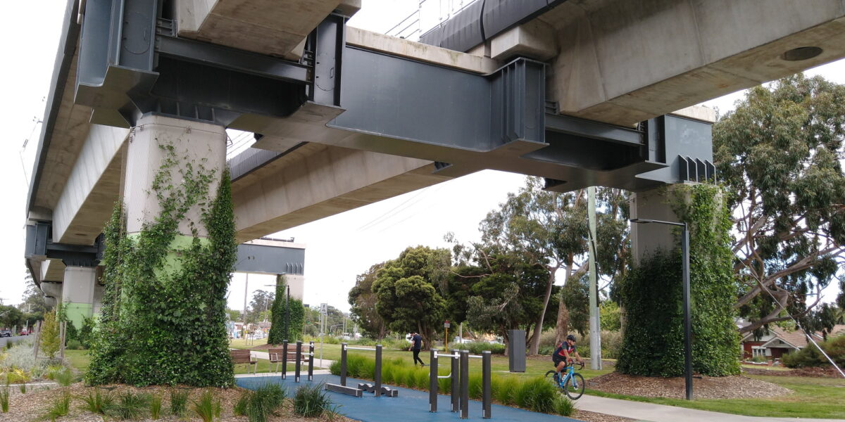
The crossing at Macaulay station – soon to be the most dangerous remaining LX in Victoria – is pretty much impossible to remove as it currently stands, due to the proximity to the creek on one side, and Citylink directly above it.
I was talking about this with some people a few weeks back, the only obvious way to separate it would be to realign the whole section from Flemington Bridge to between Macaulay and NM about 20m to the east, then raise it. But would be very expensive and require significant property acquisition, albeit mostly industrial.
Regards Evans Rd – this one isn’t really to do with the safety of the rail crossing. The issue was that the Evans Rd was a convenient through route for traffic heading towards Frankston etc, but the Evans Rd / Sth Gippy Hwy intersection was a dangerous mess, so VicRoads closed Evans Rd past Lynbrook so that only local traffic would get on and off there. Once Evans Rd was closed to through traffic, they also closed the LX, staying that way for 15+ years.
Now they’ve rebuilt the Evans Rd / Sth Gippsland Hwy intersection, and reopened Evans Rd to through traffic, rebuilding Evans Rd LX as a major thoroughfare in the process. There’s a ton more road traffic than when it originally closed due to all the new estates in and around Lyndhurst/Cranbourne West etc.
any chance you can say which 4 the libs were proposing?
@Anonymous, the top 4 proposed by the Libs were:
Macaulay Road, Kensington (as noted above, a very difficult project)
Riversdale Road, Camberwell (tram crossing)
Tooronga Road, Glen Waverley
Keon Parade, Keon Park
They also proposed Glenferrie Road, Kooyong (ranked 71st) which means under their proposal the last two remaining tram crossings would be removed.
Not sure why none of this is on their web site, at least I haven’t found it.
Something I was never really clear on was, if a project removed two crossings, was the effective score the sum risk of the two or just the higher value?
As of 2008, there were four crossings missing from the risk assessment: an unnamed road within the Queenscliff station compound and another at Swan Bay station, and both Cowans Lane and a private access road in Parwan. And of course, hundreds of pedestrian-only crossings, including six on the supposedly level-crossing-free Watergardens to Dandenong section.
@Expat – should be possible to fix Macaulay by two methods:
a) elevate the railway east of and parallel to Citylink, over the former goods tracks; or
b) divert away from Royal Park to North Melbourne, instead running under The Avenue – Royal Pde – William St, then perhaps forming the St Kilda line.
@LouisC – I also prefer road-under for Brighton Beach, although others have raised concerns re sea level rise. That’s outside my area of expertise, although I did a quick check and my guesstimate is that the road surface would be about the same height as the water at 4°C global temperature increase. Either way, you’d need to extend the Platform 1 track south about 50m as part of the works, because that would give an emergency stopping distance beyond the platform and therefore allow trains to enter the platform faster, clearing the city-end junction quicker and reducing the risk of blocking ex-Sandringham trains.
@Daniel – the LNP proposal wasn’t crossings they would separate – it was crossings they wanted Labor to include in the budget released a few days ago. No evidence yet that, if they won government in 2022, they’d even continue the LXRP program (or any of the other ongoing works); until I hear otherwise I’m going to assume their previous policies stand, including east-west link and the road intersection separation program.
Corrections:
1. Macaulay Road, Kensington – fix by rail-over, flipping the approach gradients from the south. Should be possible to avoid the signal box and station buildings, and have a new station south of the existing one. Grain sidings would need to be served via conveyor belt or pressurised pipeline from remote siding, possibly in North Dynon? That would also solve a lot of the complex shunting.
2. There’s a fifth crossing missing from the ALCAM list – Selby-Aura road, melway 124B12 on the Puffing Billy line
Re: Macaulay Station and LX, how high is the City Link tollway? Is it not possible to do something similar to Circular Quay Station in Sydney and add the train viaduct directly underneath the tollway?
ALCAM Risk Score = Infrastructure Factor x Exposure Factor x Consequence Factor
Infrastructure Factor – site-specific conditions
Exposure Factor – baseline likelihood of a collision (function of control type, vehicle/train volumes)
Consequence Factor – deaths and injuries in the event of a collision
Putting all these together, it’s a little hard to tell what the combined Risk Score for multiple crossings would be. Summing the individual scores might be a good approximation, based on exposure to risk.
And then you could do some alternative rankings that might make some sense – e.g. removing North, McKinnon and Centre Rds all in one go would put that as no. 5, rather than the individual 15, 60 & 84.
Seeing as the Risk Score is meant to represent expected death and injury, it’s probably the case that you can compare the scores, not just look at the ranking. So removing the top 5 (43,800) could be equivalent to removing the next 13-14. And as the scores get closer together purely going straight down the list might not give the best outcomes. Of course, that doesn’t mean Macauley Rd (no. 9) shouldn’t be done at some point!
And I wonder if you could compare project cost to the Risk Score as a measure of bang for buck?
We’re confusing two separate crossings here – the Macaulay Rd LX at Kensington station is potentially doable, but from what I understand the problem is maintaining access to the goods yards. Whereas the Macaulay station one at Macaulay station (under CityLink) is very difficult. Realigning the line to the east to run next to CityLink instead of under it would involve bulldozing a lot of industrial sites – possible but expensive. The other suggestion is as David mentioned, you could turn it into a metro tunnel from Flem Bridge, via Arden (probably close the current Macaulay entirely), then reemerge in the yards north of Nth Melb. But that’s also an enormous project, possibly not worth the money it would cost.
@hisashi it’s quite low – not much vertical clearance above where the wires are already. Couldn’t raise the link while keeping it underneath.
Ah, I see now – the confusion’s my fault. On the list, the one at Kensington station is the one which is rated in the top 10 most dangerous. The one at Macaulay station is a long way down the list at #77.
Assuming I can compare Risk Scores using a ratio scale – Macauley Rd crossing at Kensington station is 3 times as dangerous as that at Macauley station, even though they are only 500 metres apart. I imagine the main reasons for this would be the higher frequency of trains on the Craigieburn line (including expresses, Seymour/Shepparton trains, Racecourse/Showgrounds trains, and freight trains), and probably more vehicle and pedestrian traffic in the shopping strip area (even if the same amount of through traffic). I did wait once for a late night goods train to go through the crossing north and then reverse back through south to shunt to the siding.
Compare to the two crossings on Anderson Rd, Sunshine – again about 500 metres apart, but much closer in their risk rating, with the one on the Ballarat line being 20% more dangerous.
@Expat:
I had a look at Google Maps just now. Geez you’re right, the CL viaduct is right above. What about raising both viaducts, or as a cheaper solution, just close off the vehicle crossing and provide/improve the underpass access for pedestrians and bicycles underneath the station?
I wouldn’t think closing Macauley Rd at CityLink was a viable option – it’s part of the 402 bus route, and for vehicle traffic would just force more onto Racecourse Rd or rat run through to Arden St, where there’s another level crossing (which has a much lower risk score probably because of lower traffic volumes).
@Expat, point of order, my suggestion (b) was to run approximately south from Jewell station, not via the current alignment. The zoo would still have a station, just on the other side of the compound with the rear still served by tram 58; 57 and 59 cover Flemington Bridge, and 402 covers Macaulay, so there really isn’t much reason to keep the railway via the current alignment. Whether the diversion is done as heavy rail, light metro or light rail really depends on the capacity required (both per-service and net per-hour) and the cost (i.e. light rail could be done at ground level).
@Daniel, is anyone keeping track of non-Melbourne/LXRP crossings being separated? For example, there was something a few days ago about a pair of crossings south of Geelong?
I was quite peeved that they never bothered duplicating the Upfield line while they’d removed the Camp Road Level Crossing.
Presumably Alpine street in Ferntree Gully was chosen mainly as an adjunct to the proposed duplication.
@phil Yes it would’ve been handy if they did it at the same time as removing the crossing, I guess funds can only stretch so far. Grateful though that they at least they left room so when it is eventually duplicated the overpass won’t need to be touched.
@David
That’s a nice idea but not in the realms of possibility, except as maybe a future Metro 3 in thirty years time or something. Now that they’ve spent the bucks skyrailing it through Brunswick, the Upfield line will remain heavy rail – no chance of it getting downgraded to light rail.
[…] Since I posted the update, I’ve received some useful corrections, which I’ve applied to the list. […]
Isn’t Werribee St, Werribee due for completion in 2021?
Daniel, do you think the removal of level rail crossing will remain a priority? I would like to see the Westgarth crossing removed.
[…] are too many level crossing projects for me to track them all individually, but I am particularly interested in those at stations […]
[…] to think that by 2025 the number of crossings in Melbourne will have been roughly halved. When the 2009 ALCAM study was done, there were 180. Removal of 85 is now committed, a reduction of 47%. This would have been […]
would love an updated version, many changes and projects now not included
@Frosty, yes – I’m planning on an update later this year when we get a bit closer to the state election. I expect we’ll see Labor pledge additional crossings for removal. Not clear what the Coalition will pledge.
There may be too many buildings to knock down to achieve it (call it urban renewal!) but the Macaulay Rd LX on the Upfield line (and the Arden St one) could be removed by raising the line and moving it slightly east to be next to the Citylink rather than under it. Bonus: new station at Arden for connection to the new precinct and to the Metro Tunnel (not necessarily paid connection though)