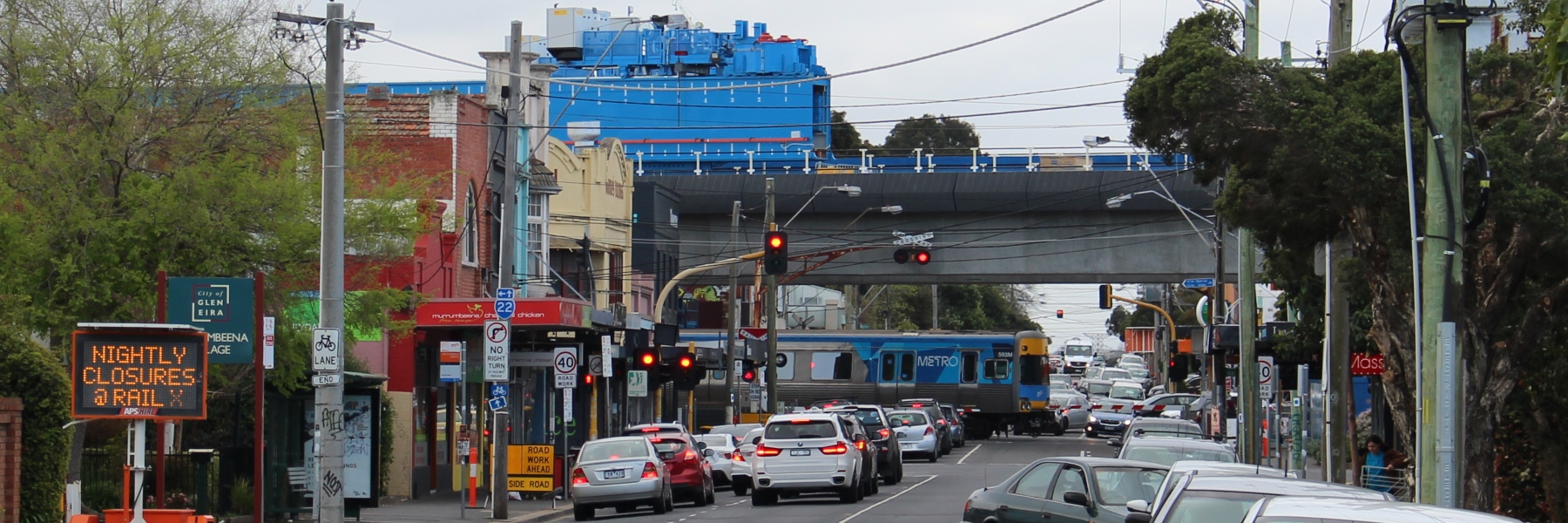
Three years ago in 2014 I attempted to summarise level crossing removals, based on the old 2008 ALCAM list, which is (still) the last public safety evaluation of level crossings in Victoria.
Things have moved on a lot since then. Labor was voted in with a policy of grade separating 50 level crossings in 8 years (20 in their first 4 year term). And you’d have to give them credit for storming ahead on this.
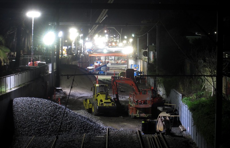
So here’s an update of the list. I’ve tried to include the latest status of the various projects completed, underway or pledged – and where I could find the information, I’ve also included which side funded them.
(This is an embedded Google Drive document… Use the scroll bar at the right to move through the list. Hopefully it works okay. If not, try here.)
Notes:
- 7. Werribee Street, Werribee. Since the ALCAM evaluation almost ten years ago, the number of trains has dropped markedly due to Regional Rail Link opening in 2015, meaning a new list would place this much further down.
- 57. Fitzgerald Road, Ardeer and 115. Station Road (Mt Derrimut Rd), Deer Park: If the list was being evaluated today, these would both rank higher, especially the latter, due to RRL moving lots of trains away from Werribee and onto this line. Derrimut has also had huge residential development in the last ten years.
- 91. Eel Race Road, Carrum is being permanently closed at the railway line, with an extension of Macleod Road under the railway line instead, because most of the traffic is actually heading to/from Macleod Road.
- 111. Park Road, Cheltenham wasn’t on Labor’s list for removal, but was added due to proximity with Charman Road.
Most of the status info is gleaned from the official Level Crossings list. Funding information was found via trawling old media releases and budget papers. “Planning funding” means money was allocated to plan a grade separation, but not to do the actual work (which obviously cost more). As I find more/corrected info, I’ll add it.
I’d originally also wanted to include the cost of each project, but this is difficult in some cases, because multiple projects have been rolled into one. The complexity also varies widely. Many include stations, but some don’t. Some have related local upgrades bundled into the cost. I’ll save that for another time.
Updates to ALCAM
The ranking shown is almost ten years old now, so a refreshed list of crossings would be shorter… but if there is one, it’s not public.
Bearing that in mind, as of September 2017:
- The top 5 have all been removed
- Of the top 10, 9 of these are expected to be done in coming years (see below).
- Of the top 20, 16 are on the list and expected to be done in coming years.
How many per year?
“Year” on the list means year completed, with it obviously being the expected year for the crossings not yet done. Some of them say “by 2022”, meaning they might move forward. And some projects don’t yet have public end dates.
With that in mind, how does it look year-on-year? If they all finish on time, it looks like 2018 is going to be a bumper year… just in time for the election!
In fact, if all of those scheduled for 2018 come in before the election, Labor will have achieved their goal of 20 in their first term, with 23 actually completed. We’ll see what happens.
Which missed out?
In the list I’ve highlighted those with no status, eg they aren’t currently proposed to be grade separated.
Remember, the Level Crossing Removal Authority didn’t choose which crossings are getting removed, and which are missing out. The crossings for removal were selected by the ALP when they formulated their policy in 2013-14.
Some worth noting that missed out are:
- 9. Macaulay Road, Kensington might be difficult because it’s on a hill; the easiest solution of elevating the road over the line would obliterate the shopping centre. It’s also nearby to the elevated Citylink tollway, and the Moonee Ponds Creek, though perhaps not so close they would cause issues? — unlike number 77, also on Macaulay Road, which is sandwiched between the creek and the tollway.
- 15. Union Road, Surrey Hills, the scene of a double fatality a year ago, and one of the last two remaining crossings on the busy City to Ringwood line (the other is ranked 88, Mont Albert Road)
- 19. Old Geelong Road, Hoppers Crossing, next to the Werribee Mercy Hospital, and in the middle of a fast-growing suburb, with far more suburban trains than ten years ago
- 75. Glen Huntly Road, Glenhuntly. Not ranked very high on the ALCAM safety list, but one of the prime causes of delays to Frankston line trains and route 67 trams alike. It along with nearby Neerim Road (ranked 152) would need to be done as one project, but would remove the last crossings between the City and Moorabbin.
My hope is that many that missed out in the initial list of 50 will be added for removal post-2022, and that government will see what the benefits of keeping this program rolling until more crossings are grade separated right across Melbourne — particularly the rest of those in the top 50 most dangerous.
- Spot any errors anywhere here? Email me or leave a comment.
- Remember, grade separation has lots of benefits other than just to car drivers
- Some different ways of prioritising crossings
36 replies on “Level crossing removals: a status update”
You missed McKinnon Road, McKinnon on your list.
90. Bondi Road, Bonbeach wasn’t originally on the list of crossings to remove, but was added due to proximity to Station Street.
This is due to adding a road bridge nearby over the Patterson river along station street in the scope of the works, which in theory would result in less traffic flow built up at this crossing. Similar to the reasoning of closing of Eel Race road.
#156 Robinsons Road, Deer Park is the third crossing affected by Regional Rail Link opening in 2015.
You have mentioned #115 Station Road (Mt Derrimut Road), Deer Park – note RRL duplicated the road making it a dual carriageway. Delays there are worse than the other two RRL level crossings due to V/Line’s inability to consistently use the ‘stopping / express’ functionality in the signalling system:
https://wongm.com/2015/11/level-crossings-delays-mount-derrimut-road-deer-park/
There are a few more level crossings that have also seen the road duplicated since 2008 – #32 Clyde Road, Berwick and #193 Cardinia Road, Pakenham are two.
Sorry for a triple post:
90. Bondi Road, Bonbeach wasn’t originally on the list of crossings to remove, but was added due to proximity to Station Street.
You meant Mascot Ave Bonbeach, anyways, the names of crossings here are confusion, get mixed up easy.
Unfortunately, the crossing removal at Buckley Street, Essendon, is NOT ‘rail under’. Its road under existing rail. This is despite this option not being the best option and much local opposition. It is certainly the cheapest option. As part of this Buckley street will be reduced from 4 lanes to 3.
Didnt they just say the croydon station will be done in the next few years?
Thanks all – I knew I’d mess some of them up. Making some corrections.
@Ray, there’s no project earmarked for Croydon. The nearby projects are Manchester Road (Mooroolbark) and Maroondah Highway (Lilydale)
@Ray The planning done at Croydon with an elevated solution was via consultants employed from local council. There is no commitment as of yet to include that crossing for grade seperation. Here’s the video if anyone else is curious about it. https://www.youtube.com/watch?v=6WKSDCMU7GU
“90. Bondi Road, Bonbeach wasn’t originally on the list of crossings to remove, but was added due to proximity to Station Street.”
You’re thinking of the crossing between Mernda Av and Mascot Av, which is being closed off, with Station St getting a new road bridge over Patterson River to compensate as part of the Carrum station grade separation.
FYI #54 Grange Road Alphington is rail under, not rail over
Which Maidstone St, Altona crossing is which? The list doesn’t distinguish between no. 47 and no. 109.
@Nick, thanks. Haven’t seen the info about the Station St (between Mernda and mascot) crossing – will go looking, but in the mean time, have removed the note about Bondi Road.
@Ross, thanks.
@Max, I’ve added a note to distinguish which is which.
I believe Moreland Road Brunswick has its contract awarded if I’m not mistaken?
@Daniel, I found the info about that particular crossing on the LXRA publications, in this publication I linked shows a diagram drawing which crossing are removed and the new bridge over the Patterson river. The crossing on the left is the extra crossing being removed, and the crossing in Station street will be realigned as an extension of Macleod Road and with this alignment the removal of Eel Race Road makes more sense. Hope this helps :)
http://levelcrossings.vic.gov.au/__data/assets/pdf_file/0013/100282/LXRA0496-F8-Carrum-Factsheet-Traffic_10.pdf
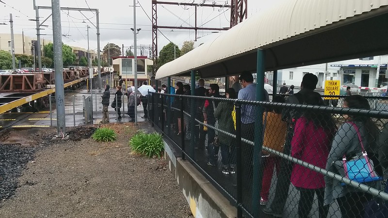
Does level crossing removal mean the death of sheltered waiting rooms?
Consider the old Epping station – it had plastic chairs in (I think an air conditioned room) where you could wait for the train. I do not think the new Epping station has a room.
Of course Lalor station never had such a thing but it was not a staffed station.
If anyone wants to see what a waiting room looked like, visit Broadmeadows Station.
But again, does the removal of level crossings mean the death of waiting rooms?
Macaulay Rd, Kensington may require an innovative hybrid solution with the railway slightly elevated and the road slightly depressed. This means rebuilding Kensington station and possible opportunity for quadruplication between North Melbourne and Newmarket for Flemington Racecourse trains to use at certain times. But the freight grain train sidings south of the crossing is another challenge I don’t have a solution for atm.
Also there was a case study for removal of Union Rd, Surrey Hills level crossing back in the 70s, and the preferred solution back then was road over. 40+ years of substantial growth and property development has occurred around the station and I believe shifting the railway above or below the road are now the most viable options given the railway east of Surrey Hills is uphill towards Mont Albert.
@Jacob, Bentleigh station has a sheltered waiting room, and the design for some of the other new stations has them. The catch? They’re not at platform level; they’re on the concourse, which is a ramp/step/lift/escalator ride from the trains.
In the Bentleigh case, the waiting room does provide far better cover from wind and rain than anywhere else in the station, and thanks to large windows, it feels safe even though it’s enclosed, and is visible from the street and the booking office. You can also see the Next Train indicators on the concourse.
However, I rarely see people using it.
As a resident of Kensington i quite like the Macaulay Road crossing even though it’s a pain to drive through.
From a pedestrian perspective it adds to Kensington’s charm.
Would it be wrong to say that it should stay?
Any solution is bound to crush the village feel of the place.
Traffic movement isn’t high on Macaulay Rd and nor should more be encouraged.
Regardless, any benefit to traffic flow is muted due to continued existence of the Upfield line crossing just down the road. (Which might just prove to be impossible to remove without re-routing the Upfield line)
And businesses suffer financially and the govenment doesnt care if you go bankrupt, take out loans or have to close and walk away from years of hard work. Our suffering has been down played as this is the price we pay for the future, i just wish the govenment acknowledged what they are doing to us and the price we have paid, not only financial but in stress, anxiety, depression and sleepless nights.
@Pierre
While I hate to have a level crossing remain for the sake of it, I would understand that removing the Macaulay Road level across will actually induce traffic through the shopping village.
I can’t actually think of a good way to remove the crossing. I wonder if it’s better to just close it completely and get traffic to move through Racecourse Road and Lloyd Street.
Daniel, thanks for the info regarding the waiting rooms.
If we want people to switch from cars to trains, we should have shelters at every station – not necessarily air conditioned but if you consider Roxburgh Park station, it is so windy due to a lack of walling and roofing.
There should be a roof along the entire length of the station and the roof should be aligned with the stairs but the roof is actually horizontal way above the stairs! An extremely poor design.
Oh, so much to say! I’ll try to be brief.
Macaulay Rd, Kensington: While I agree with @Pierre that the railway does help provide a village atmosphere, it should, in some way, be removed to benefit both the Craigieburn and Racecourse lines. Perhaps either @Arfman’s or @Gene ‘s suggestion is “the” solution?
@Jacob mentions several stations and crossings in the north west. Epping station does in fact have a waiting room. Roxburgh Park station, well, on one hand that station is not worth talking about, but on the other hand, it needs discussion (and eventually action). As for Broadmeadows station, I wonder what a new design will be like, though I’m looking forward to a Meadowlink grade-separated crossing.
Lalor station and Paschke Cr crossing: there are at least 2 further issues to consider. 1. Access to the present Epping stabling and maintenance (?) facility. Will this be relocated to Mernda? 2. The future Wollert extension junction. Personally, I’m looking forward to all of the level crossings north of the Ring Road being removed.
@Chris, I’d be surprised if Moreland Road had been awarded without any other level crossing down to, at least, Park St. It’s interesting that the present local member of parliament for much of that section will no longer be in that seat after the next election. As @Daniel alludes to, the achievement of removing level crossings elsewhere in Melbourne could be used by the replacement candidate.
Hi Daniel,
Not sure which would be the best story to add this comment to, but have you seen this?
https://www.theguardian.com/cities/2017/oct/02/rise-of-the-yimbys-angry-millennials-radical-housing-solution?CMP=Share_AndroidApp_Outlook
Rise of the yimbys?
As for Glenhuntly Road Glenhuntly, I blame that local Caulfield Liberal MP (Mr David Southwick-funded by local “steptoe” Mr Harry Rose) for failing to lobby the Andrews Government hard enough to come to some compromise in the X-ing removal. You’re DEAD RIGHT, about this ghastly XINGs cause of delays to the 67 tram. By the time this tram arrives at Elsternwick train station, this tram is packed & overfull!
Local “junkshop” dealer (Mr Harry Rose) blames the Andrews Govt for the Glenhuntly level Xing, not being removed. Get over it Harry! It was your ‘goofy’ Liberal Party candidate (Mr David Southwick) who failed to persuade Premier Andrews of our priority status, whilst Mr Nick Staikos (Labor MP for Bentleigh) got off his backside and got 3 level Xings removed!
While the Liberal Party could have done more to get the Glen Huntly Rd level crossing removed (such a remove it when they were in office or promise to do it if re-elected), the Government`s list of 50 crossings was decided and announced from opposition (when the Liberals held Bentleigh) and did not include Glen Huntly Rd. The Liberals had already started the ball rolling on North Rd, Ormond before the election, which is why the ALP continued with that and it was the logical thing to do to do the other 2 crossings in that section on their list at the same time.
If their were greater Liberal campaigning to remove the level crossing, that may help it be included in any extension of the government`s level crossing removal program, as may the smaller Liberal margin in Caulfield.
[…] other week I noted the current state of level crossing removals across Melbourne, and that Glen Huntly Road / Glenhuntly Station [1] isn’t on the […]
[…] the level crossing removal program is resulting in many stations being rebuilt to modern standards. This is a ramp down to the platforms at Bentleigh station […]
It’s actually Macauley road, Macauley that’s under the elevated toll road. One solution to this problem would be to divert the Upfield railway line, which would now serve the University.
[…] with dozens of similar projects underway around Melbourne, it seems to me they need to get better at ensuring everything gets […]
Dear Daniel
Firstly, I must acknowledge the hard work and running from pillar to post keeping not only an hawk’s and keeping the Melbourne’s residents abreast on all matters of public transportation with fear or favour as I have seen and followed you during my term consisting of 7 years and missed the Council elections in 2016 in line of duty, a subject to open book.
I have seen the link to which after study showed that there were high priority to attend to railway stations for immediate grade separation where the damage to life, business and communities with majority of ethnic citizens that shocked the community in Springvale, Clayton and others that can be interestingly read from your list of priorities in grade separation. As we know the work on the planning, processing and budget was as you say was decided by liberals and as usual any thing stuck in a political machinery needs jelly to pull it out for credit. Having said that Bentleigh, McKinnon an Ormond (which do not appear to be seen on the list were attended to first and quickly for a cost of nearly half a billion dollars. Dave by snatching someone else’s live, do you believe it is ethical and that too when the MP in those suburbs may not be interested in re-election. This is a wild guess. Can anyone see the gambit and ploy in shuffling the cards and what is the intention. Are we working ensure something else benefits in November 2018?
E&O
[…] Definitely progress! After only a few grade separations in the past few decades, it’s happening in a major way now, with dozens to be done in the next few years. […]
Dave, I believe you mean 2 crossings (not 3). Read the data regarding Ormond. The tenders went out before the election and I remember workers checking the crossing extensively in 2013 and 2014, before the Andrews government took power.
The list represents sufficient accurate detail to disprove the naysayers about which crossing was started or completed by who. I applaud accurate information, no matter which side of the political spectrum one is on.
Cheers.
with the introduction of the regional rail link one of Werribee’s crossings Werribee street Werribee has turned into of the least used crossings when the rail link was opened so I ask why does this crossing have to be removed now that its only has about 2 trains a day go through it the next crossing to be ear marked should have been the crossing at hoppers crossing this is a nightmare this crossing with pedestrians playing Russian roulette when crossing nearly getting missed by trains cars blocking the tracks there has been so many near misses at this crossing its not funny this crossing is very dangerous and needs to go cameras also need to be installed so they catch people for their own safety I would rather see some people loose points and cash for a fine than hear about another death at a crossing that should be removed
Government announced if returned at the next month’s State election, both Glenhuntly and Neerim Road crossings are to be removed. At last! Should have been done while Ormond, McKinnon and Bentleigh were being done. More disruption for the commuter on the Frankston line. Better late than never.
Daniel you should be aware that in risk-assessment circles, risk assessments such as the ALCAM 2008 list are generally past their use-by date 5 years later.
Take the case of Ferguson Street Williamstown: it is rated “no priority” by VicRoads in its 2014 strategic assessment of level crossings but is on the ALP’s list. It had a high rating in the ALCAM 2008 list but this was made redundant in 2014 when automatic-locking gates were installed on the pedestrian pathway over the tracks. This pathway is now one of the safest crossing points for pedestrians in the entire crossing precinct! Elsewhere, pedestrians have to dodge traffic as there are insufficient designated crossing points.
I recently saw the pedestrian path over the tracks on Moreland Rd near the Moreland station and was shocked to see absolutely no pedestrian protection at all – not even a ‘zig-zag’ metal maze. You could walk point blank straight across the tracks! Level crossings could be all made much safer with simple improvements such as the gates.
[…] then, three level crossings are gone (Bentleigh/McKinnon/Ormond). Labor deserves credit for making this happen, even if it was […]